


|
||

|

|
|

|
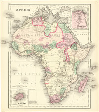
Fine Map of the Continent of Africa Locating "Negroland" and "Man-Eaters"
Clear, detailed map of the continent of Africa by prominent London mapmaker Emanuel Bowen.
The map divides the continent into large regions, including Barbary, “Sara or the Desart,” Ethiopia Exterior, and Monomotapa. A large section of west Africa is labeled as Negroland, while Guinea includes the Grain Coast, Tooth Coast, and the Gold Coast. This shows how Europeans saw West Africa, as a source for commodities including, at this time, human beings.
The map includes a compass rose and a decorative cartouche in the lower right. The cartouche features a man astride a horse, a crane, several elephants, and, bizarrely, a boy riding a crocodile.
Interestingly, Bowen shows the source of the Nile as lying in “Ethiopia or Abissinia,” rather than farther south in the great lakes of south-central Africa, as many other contemporary maps did. However, beyond the northeastern portion of the continent, there are few geographic features included in interior Africa.
The map reflects the limited contacts of Europeans across the continent, which were then confined primarily to coastal trading regions. However, this does not stop Bowen from offering annotations about peoples and places of the interior. For example, in “Mono-Emugi,” are supposed “Anthropophages or Man Eaters.” In “Ambutua or Toroa” and “Monomotapa” are “Gold Mines,” and the latter also has a convent of Dominicans, one of the early attempts at conversion in that area. “Mataman” has “A savage people.” Most of these notes, except for the Dominicans, were based merely on rumor.
Emanuel Bowen (1694?-1767) was a British engraver and print seller. He was most well-known for his atlases and county maps. Although he died in poverty, he was widely acknowledged for his expertise and was appointed as mapmaker to both George II of England and Louis XV of France. His business was carried on by his son, Thomas Bowen. He also trained many apprentices, two of whom became prominent mapmakers, Thomas Kitchin and Thomas Jeffreys.
![[ Ancient World ] Christianographie](https://storage.googleapis.com/raremaps/img/small/80305.jpg)
![[ Africa. ] Tabula IIII. Aphricae. Hae Sunt E Cognitis Totius Orbis . . . (title on verso)](https://storage.googleapis.com/raremaps/img/small/103154.jpg)
![[ Air Travel Routes in Africa ] Ministre de l'air regie Air Afrique](https://storage.googleapis.com/raremaps/img/small/89402.jpg)