|
||

|

|
|

|
Stock# 78512
Description
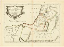
Rare English map of the Holy Land, published by Richard Blome in 1687.
The map presents a detailed treatment of modern day Israel and environs, based upon biblical sources, including early towns, roads, mountains, and references to biblical places and the tribes of Israel and other early inhabitants of the region. The map illustrates the travels of the Apostle Paul along the Mediterranean Coast.
Blome's map is a based upon an earlier Dutch map by Claes Jansz Visscher.
The map appeared in Joseph Moxon's Sacred Geographie or Scriptural Mapps, first published in 1671.
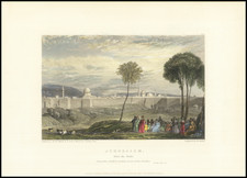
![[Beirut, Lebanon] The Port of Beirout in Syria](https://storage.googleapis.com/raremaps/img/small/76131.jpg)