|
||

|

|
|

|
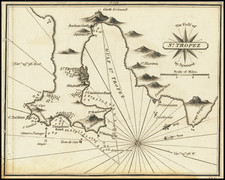
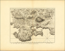
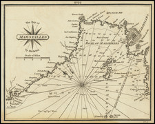
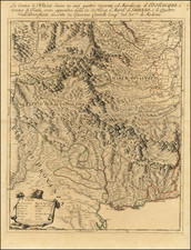
Attractive navigational chart showing Cassis and environs, in Provence (France).
Oriented with southeast at the top, the map includes numerous soundings and shows onshore details which would have been of use to sailors, for example, towns and topography. Several islands are also shown and named.
Cassis
The area around Cassis was first occupied between 500 and 600 BC by the Ligures, who constructed a fortified habitation at the top of the Baou Redon. The current site of Cassis could have been inhabited by the Greeks, though no proof has yet been found.
During the Roman times, Cassis was part of the maritime route made by the Emperor Antoninus Pius. It was a small village, established mainly around the Arena and Corton beaches.
From the 5th to the 10th century, invasions by foreign tribes led the population to seek refuge in the castrum, a fortified city that, in 1223, became the property of the Seigneurie des Les Baux-de-Provence.
In the fifteenth century, Cassis was ceded to the Counts of Provence, then René of Anjou gave the town to the Bishops of Marseille, who ruled the town until the Revolution of 1789.
Jacques-Nicolas Bellin (1703-1772) was among the most important mapmakers of the eighteenth century. In 1721, at only the age of 18, he was appointed Hydrographer to the French Navy. In August 1741, he became the first Ingénieur de la Marine of the Dépôt des cartes et plans de la Marine (the French Hydrographic Office) and was named Official Hydrographer of the French King.
During his term as Official Hydrographer, the Dépôt was the one of the most active centers for the production of sea charts and maps in Europe. Their output included a folio-format sea atlas of France, the Neptune Francois. He also produced a number of sea atlases of the world, including the Atlas Maritime and the Hydrographie Francaise. These gained fame and distinction all over Europe and were republished throughout the eighteenth and even in the nineteenth century.
Bellin also produced smaller format maps such as the 1764 Petit Atlas Maritime, containing 580 finely-detailed charts. He also contributed a number of maps for the 15-volume Histoire Generale des Voyages of Antoine François Prévost.
Bellin set a very high standard of workmanship and accuracy, cementing France's leading role in European cartography and geography during this period. Many of his maps were copied by other mapmakers across the continent.
![[Paris Environs - Southeast] Carte Routiere pour Automobilistes & Cyclistes -- Environs de Paris Section Sud-Est](https://storage.googleapis.com/raremaps/img/small/95862.jpg)