This item has been sold, but you can enter your email address to be notified if another example becomes available.


|
||

|

|
|

|
Stock# 75519
Description
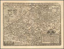
Striking example of the scarce English edition of Waghenaer's sea chart showing the coastlines of Southern Flanders, Picardy and Normandy.
The chart is oriented with Southeast at the top and includes the modern cities of Nieuwpoort, Dunkerque, Gravelines, Calais, Boulogne-sur-Mer and Dieppe, as well as Dover, Winchelsea and Rye on the Kent Coast of Britain.
The chart is richly embellished with compass roses, sea monsters, sailing ships, and rhumb lines.
Shirley says of the English Waghenaer:
"In 1588 Anthony Ashley, clerk to the Privy Council, was commissioned by Sir Christopher Hatton to prepare and English language version of... Waghenaer's... Spieghel der Zeevaerdt... For the English version new plates were engraved in England by Theodore de Bry, Jodocus Hondius, Augustine Ryther and Johannes Rutlinger... The plates were later acquired by Jodocus Hondius, who published another edition in 1695" (Shirley, British Library). Such was the popularity of this and other versions in English, that sea atlases became universally known as "waggoners".
Condition Description
Old Color
![[Franche-Comte] Burgundiae Comitatus Recentiss. Descriptio . . . 1596](https://storage.googleapis.com/raremaps/img/small/75250.jpg)
![Burgundiae Ducatus [on sheet with: ] Burgundiae Comitatus. (1641 Edition!)](https://storage.googleapis.com/raremaps/img/small/94433.jpg)
![[Metz] Le Vray Pourtraict de la Ville de Mets](https://storage.googleapis.com/raremaps/img/small/74161.jpg)