


|
||

|

|
|

|
"...we're all astronauts aboard a little spaceship called Earth" - Buckminster Fuller
Nice example of Buckminster Fuller's updated Dymaxion Map of the World, which utilizes photography from space.
Includes diagram "Reversing the transformation: from two to three dimensions"--how to cut and fold the map to form a dymaxion globe. A note provides that it has been "Produced by mosaicking hundreds of individual satellite images acquired from the NOAA series of weather satellites."
In the 1960s, Fuller, along with co-cartographer Shoji Sadao, alternative projection map, called the Dymaxion map. This was designed to show Earth's continents with minimum distortion when projected or printed on a flat surface.
In the 1960s, Fuller developed the World Game, a collaborative simulation game played on a 70-by-35-foot Dymaxion map, in which players attempt to solve world problems. The object of the simulation game is, in Fuller's words, to "make the world work, for 100% of humanity, in the shortest possible time, through spontaneous cooperation, without ecological offense or the disadvantage of anyone".
Fuller Projection A new view for the new millennium
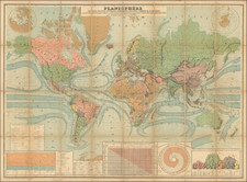
Traditional world map projections often distort and divide the land masses in their attempt to show the curved surface of the earth as a flat projection. For example, Greenland appears substantially larger than Australia although its land mass is actually smaller, the massive continent of Asia does not fit unless divided, and the Polar regions are so grossly distorted that they must be shown separately in order to be seen in their entirety.
The projection used for this map, also known as the "Dymaxion Map", was created by Buckminster Fuller, distinguished mathematician, inventor and 20th Century visionary. It is the only flat map of the entire surface of the earth which reveals our planet as it really is one island in one ocean -with out any visible distortion of the relative shapes and sizes of the land areas, and without splitting any continents.
Given a way to visualize the total planet with greater accuracy, humans aboard Spaceship Earth will be better equipped to address the challenges to humanity's future.
Richard Buckminster Fuller was an American architect, systems theorist, author, designer, inventor, and futurist. He styled his name as R. Buckminster Fuller in his writings, publishing more than 30 books and coining or popularizing such terms as "Spaceship Earth", "Dymaxion" (e.g., Dymaxion house, Dymaxion car, Dymaxion map), "ephemeralization", "synergetics", and "tensegrity".
Fuller developed numerous inventions, mainly architectural designs, and popularized the widely known geodesic dome; carbon molecules known as fullerenes were later named by scientists for their structural and mathematical resemblance to geodesic spheres. He also served as the second World President of Mensa International from 1974 to 1983.
![[ World on Mercator's Projection ] Mappe-Monde suivant la projection de Mercator -- 1832](https://storage.googleapis.com/raremaps/img/small/99031.jpg)