This item has been sold, but you can enter your email address to be notified if another example becomes available.


|
||

|

|
|

|
Stock# 69736
Description
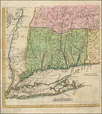
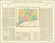
Fine example of Wilcox's scarce map of New England, published in Middletown, Connecticut, in 1836.
Perhaps the most fascinating aspect of the map is its focus on factories, which are shown in the small insets and throughout the map. the map notes at the top center that it contains "the Factories, Churches, Academies, Banks &c. There ared 1244 Facgtories [shown] . . ."
At the bottom center, the states seals of the 3 stats are shown.
The 3 states are hand colored by townships, with plans of larger cities, including:
- New York City
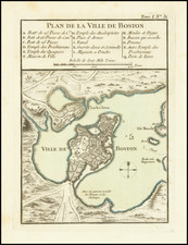
- Boston
- Harford
- Providence
- Norwich
- New Haven
- Salem
- Lowell
- New Britain
- Warwick & Coventry
- Pawtucket
- North Adams
- Canton
Condition Description
Wall map on linen, with original rods. Toned and soiled. Several tears at the top art of the image and sides, with some minor chipping and loss.

![[Stage Harbor, Cape Cod, Massachusetts] port. fortuné](https://storage.googleapis.com/raremaps/img/small/78785.jpg)
![[New England] Tierra Nueva](https://storage.googleapis.com/raremaps/img/small/64626.jpg)