


|
||

|

|
|

|
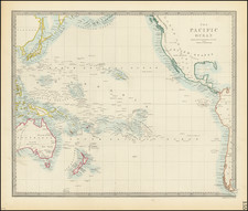
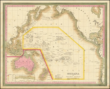
Early map of the Pacific, centered on the Sandwich Islands, and showing the full coastline of the Americas and Asia. Excellent detail in the Pacific, including explanations of the Capitals, Important Towns, Common Towns, etc. Wilkes discoveries in the Antarctic are shown in an inset. The first edition of this map, which appeared over the next 30 years. This map is from an early edition of Tanner's New Universal Atlas, first issued in 1834. The Atlas would become the most popular American Atlas between 1834 and 1860, published annually, first by Tanner and later by Mitchell, Cowperthwait, and DeSilver. Tanner's career as a mapmaker began in the early 19th Century. He had a hand in publishing many of the most important American maps of the first half of the 19th Century. His business was carried on by his son Thomas and Henry Carey and flourished until the middle of the 19th Century.