


|
||

|

|
|

|
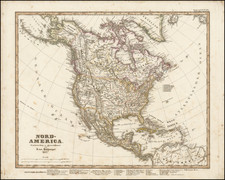
Fascinating educational map of North America, bearing the engraver's signature of Neele, Strand (London).
The map presents a remarkable look at North America at about the time Lewis & Clark set out on their expedition to find a practicable route up the Missouri River, across the Rock Mountains and on the the Pacific Coast.
The map follows the cartographic features of Arrowsmith's maps of 1802, and most notably the numerous tentative water routes which are shown as possible tributaries of the Upper Missouri River, draining directly from the single cordillera depiction of the Rocky Mountains.
The map includes at least 3 symbols which are apparently intended as prompt for students to add the names of cities, Indian Tribes and major points.
The map appeared in A general and classical atlas: accompanied with a concise treatise on the principles of geography; and with a few practical remarks on the application of maps to the purpose of instruction. By the Rev. Edward Patteson, M.A. of Richmond, Surrey. Printed for the author, by G.A. Wall, Richmond: and sold, in London by Messrs. Rivington, St. Paul's Church-Yard; Mr. Faden (et al.) ... 1804.

![[The Final State] A New Map of North America, with the West India Islands, Divided according to the Preliminary Articles of Peace, Signed at Versailles, 20 Jan. 1783, wherein are Distinguished The United States and the Several Provinces, Governments &c Which Compose the British Dominions . . . 1794](https://storage.googleapis.com/raremaps/img/small/89085.jpg)