


|
||

|

|
|

|
German Published Wall Map of the Republic of Guatemala
Rare large map of Guatemala, published at the direction of the Government of the Republic of Guatemala, under the direction of Claudio Urrutia.
Urrutia's map is colored by elevations and includes separate diagrams showing
- elevations of volcanoes, mountains and rivers
- Important Crops and the altitudes at which they grow
- Monthly Rain and Temperature Tables
- Various Statistical Data
A large inset map notes shows the ancient kingdom of Guatemala at the time of its discovery and conquest.
The map was engraved and printed by the Geographical Workshop of J. Kohlberg in Hamburg and includes the imprint of Ludwig Friederichsen & Company of Hamburg.
The Guatemala-Hamburg connection was likely and outgrowth of the coffee trade. German owned coffee plantations were the dominant force in Guatemala between 1887 and 1929.
Ludwig Friedrichsen
Ludwig Friedrichsen was a German geographer and cartographer as well as a publisher and colonial politician. In 1873 he founded the Geographical Society in Hamburg, serving as its first secretary.
Friedrichsen is known to have published several maps of Central and West Africa and the South Seas, the latter coming from his involvement in the Hamburg South Sea Expedition, 1908-1910.
Rarity
The map is very rare. OCLC locates copies at Duke University, Newberry Library, Penn State University Sachsische Landesbibliothek, and University of Mannheim.
This is the first example of the map we have ever seen on the market.
![[Galapagos] Carte de la Cote Occidentale D'Amerique Comprise Entre Le Golfe de Tehuantepec et le Golfe de Guayaquil (Amerique Centrale, Nlle Grenade, Equateru) . . . .1864](https://storage.googleapis.com/raremaps/img/small/57942.jpg)
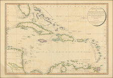
![[Caribbean]](https://storage.googleapis.com/raremaps/img/small/85443.jpg)
![La Florida [with] Guastecan [with] Peruviae Avriferae Regionis Typus](https://storage.googleapis.com/raremaps/img/small/89451.jpg)