|
||

|

|
|

|
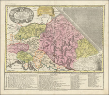
Finely executed map of Vienna, created by Ludwig Schmidt in Berlin in 1783.
The map is a reduced version of Schmidt's map of 1780-81.
Mapping Vienna
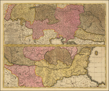
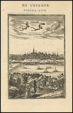
While innumerable maps and views of Vienna had been published since the inclusion of the first view of city in the Nuremburg Chronicles (1493), up to the end of the 18th-century no scientific survey of the City and its environs had been undertaken. This was not because of a shortage of skilled surveyors and advanced scientific equipment in the city. Indeed, the Austrian military engineers were amongst the finest surveyors in Europe. Rather the imperial army strongly discouraged the publication of detailed surveys of cities, out of fear that it might fall into enemy hands. The army was so concerned that they even discouraged the actual act of surveying cities in and of itself, lest it result in some illicit map. While the authorities in many European capitals had already permitted, and in some cases funded, scientific surveys of their capitals, placed in the heart of Europe, in the path of numerous foreign armies, the Austrians had no such luxury.
The leading cities of the Austrian Empire, such as Vienna, Prague, Brussels and Antwerp (Belgium was then the Austrian Netherlands) were vibrant commercial and cultural centers. Civilian administrators and commercial interests urgently needed accurate general maps of cities to effectively carry out their mandates. Since the end of the Seven Years' War in 1763, tension over the question of permitting urban surveys developed between military and civilian stakeholders. Gradually, urban surveys of various kinds were permitted by the military, whose active cooperation was often a prerequisite to completion of such surveys.
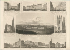
A major breakthrough came in 1769, when Josef Daniel Hüber created a monumental building-by-building panoptic view of Vienna. Published in 1777, it ranks as one of the finest accomplishments of urban mapping and topographical artistry of the 18th-century. Importantly, however, Hüber's work only depicted central Vienna immediately around and within the city's walls, a view of limited military utility.
Critically, the regional government the Austrian Netherlands proved to be much more lenient on the mapping question than the authorities in metropolitan Austria. Indeed, from 1771 to 1778, all of modern Belgium was scientifically mapped by Joseph-Jean-François, Comte de Ferraris, resulting in the publication of the Carte Marchande. Permitting the even more detailed mapping of cites and their immediate surroundings was seen the natural next step.
Shortly thereafter, Maximilian von Grimm received the support of the local authorities to conduct the first scientific survey of Antwerp. This was published as the Plan der Stadt Antwerpen an der Schelde in oestreichischen Niederlanden (Augsburg, 1785).
The highly quality and practical utility of this map won Grimm a great deal of notice and acclaim throughout the Austrian Empire. Civilian stakeholders in Vienna were highly desirous of having a similar plan made of the imperial capital and its burgeoning suburbs, however, resistance continued from military circles.
Ironically, it was military considerations that eventually led to the undertaking of the first scientific survey of Greater Vienna. Historically, during times of military emergency, the Austrian army had a difficult time rounding up conscripts in the myriad streets of Vienna. Houses were not numbered and the old signs, such as 'under the Golden Rooster', that had traditionally identified residences and shops were increasingly hard to sight, or were taken down altogether. To help army 'press gangs' locate specific residences, on Christmas Eve 1770, Empress Maria Theresa instituted the policy of the "general conscription of souls and houses" ordering all of the capital's residences to "make the numbers on all houses legible and visible, on punishment of 9fls. [Silver Florins]".
From 1771 onwards, the city's streets were gradually numbered, however, this process was poorly coordinated and the haphazard numbering proved to be confusing. The situation was not helped by the fact that the citizenry generally resented the measure, so did little to help rationalize the process.
![[ Railroad Map of Austro-Hungarian Empire ] Eisenbahnkarte von Oesterreich-Ungarn](https://storage.googleapis.com/raremaps/img/small/89257.jpg)
![(First state!) Lacus Constantiensis XX Tab Nova [The Bodensee]](https://storage.googleapis.com/raremaps/img/small/94703.jpg)