|
||

|

|
|

|
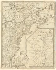
Scarce map of Florida, the Gulf Coast, the Southwest, Mexico and Central America, from the second edition of De Fer's Atla Curieux. Th map includes notes along the coastline reflecting the discovery of the Mouth of the Mississippi and La Salle's time in Texas in 1685. Longitudinal notes in the lower cartouche. Excellent detail in Mexico and Central America and along the coast of Florida. Extends North on the Rio Grande to Santa Fe. Names name Pascogoula (Pascobula), Biloxi (Biloky), Mobile and Biscayne Bays. This map was apparently not issued in all editions of the Atlas Curieux and tends to be much scarcer than the other North American maps. Minor repaired tear in the Gulf of Mexico, else a nice example in old color. Normally a $1200.00 map.
Nicholas de Fer (1646-1720) was the son of a map seller, Antoine de Fer, and grew to be one of the most well-known mapmakers in France in the seventeenth century. He was apprenticed at twelve years old to Louis Spirinx, an engraver. When his father died in 1673, Nicholas helped his mother run the business until 1687, when he became the sole proprietor.
His earliest known work is a map of the Canal of Languedoc in 1669, while some of his earliest engravings are in the revised edition of Methode pour Apprendre Facilement la Geographie (1685). In 1697, he published his first world atlas. Perhaps his most famous map is his wall map of America, published in 1698, with its celebrated beaver scene (engraved by Hendrick van Loon, designed by Nicolas Guerard). After his death in 1720, the business passed to his sons-in-law, Guillaume Danet and Jacques-Francois Benard.