|
||

|

|
|

|
Cold War Mapping of the Dallas Region.
Detailed color-printed Soviet map of Dallas, published in 1967.
The map features an expansive, 44-item key elaborating various methods of transport, size of cities, airports, ground cover, etc.
The map goes a bit west of Roswell, New Mexico in the west, Marshall, Texas in the east, Junction City, Kansas in the north, and Athens, Texas in the south.
As detailed John Davies' and Alexander J. Kent's book The Red Atlas the Soviet Union undertook an unparalleled mapping project after World War II, which resulted in the production of hundreds of thousands of map sheets, covering all of the world at a variety of scales. The Soviet mapping project stemmed in part from a military doctrine which put mechanized warfare first (as opposed to air and missile forces). This approach necessitated detailed maps of railroads and highways, over which tank units would travel in the event of ground invasions.
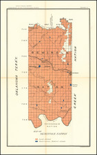
![Indian Territory [with Colorado on verso]](https://storage.googleapis.com/raremaps/img/small/74706.jpg)