
This item has been sold, but you can enter your email address to be notified if another example becomes available.


|
||

|

|
|

|
Stock# 58602
Description
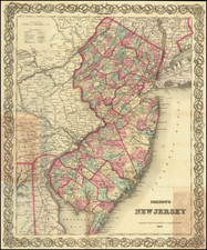
A detailed and attractive map of New Jersey, hand-colored by county, showing roads, canals, towns, steamship routes and other interesting details.
Includes railroads and proposed railroads and a number of tables of distances, stage routes, canal routes and populations. A full color example.
Condition Description
Some browning on the edges of the map.
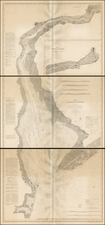

![[Revolutionary War Plans of New York, Boston, Charleston, Delaware River to Philadelphia & Havana] Various Plans and Draughts of Cities, Towns, Harbours &c . . .](https://storage.googleapis.com/raremaps/img/small/83450.jpg)
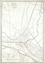
![Map [No. 2] of Property owned by the Rutherford Heights Association To Be Sold At Auction, May 16, 1871](https://storage.googleapis.com/raremaps/img/small/71908.jpg)