|
||

|

|
|

|
Ecuador Plays the Imperialism Card Against Peru -- The Ecuador-Peru Territorial Controversy
Rare separately published propaganda map, published by the Departmento de Prensa y Publicaciones del Ministerio De R.R. Del Ecuador.
The map outlines the claims by Ecuador to a disputed territory which had been the subject of dispute for more over 100 years and which would continue in dispute for another 50+ years, until finally resolved in 1998.
As noted in the introduction:
The Ecuador - Peru Territorial controversy is unique perhaps in all history, in that the fundamental issue at stake is so clear-cut and obvious that the impartial observer has merely to glance at the map of the two countries to arrive at the only possible conclusion.
Indeed, the un-biased observer, without recourse to ancient archives or consultation with the conflicting parties themselves, need only allow the facts to speak for themselves in order to reach the inevitable solution.
The accomppanying (sic) map speaks more eocuently (sic) than any words, revealing a series of facts which cannot be denied, and point to one, AND ONLY ONE, motive for the controversy, to wit: the un-American and unacceptable motive of IMPERIALISM. Let these facts speak for themselves.
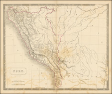
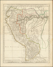
The Ecuador-Peru Border Controversy
The territorial dispute between Ecuador and Peru was the longest-running international armed conflict in the Western Hemisphere. Based upon each country's interpretation Spanish Royal Proclamations, the conflict began after each gained independence from Spain.
The two nations were at odds with one another as early as 1824. The dispute continued through the late 19th century and beginning of the 20th century. Numerous attempts were made to define the borders, but both governments could not come to an agreement acceptable to their constituencies. A war between Colombia and Peru occurred during 1932 and 1933 in the Eastern region of the Amazon territories and resulted in the official designation of the Putumayo River as a border between Colombia and Peru; but sectors of the society considered this detrimental to the Ecuadorian cause, with Colombia now recognizing Peru's rights to the territory that Ecuador claimed as its own.
An agreement recognizing territories in de facto possession by each country was signed in 1936, but minor military skirmishes began to occur in 1938. Tensions escalated, and war broke out in July 1941, and officially came to an end with the signing of the Rio de Janeiro Protocol on January 29, 1942. The treaty was intended to finally bring the long-running territorial dispute to an end, but in 1960 the then president of Ecuador Dr. José Mª Velasco Ibarra proposed to the Congress a thesis of nullity based on the fact that the 1942 protocol was forced upon the Ecuadorian government under duress.
A brief military clash took place in early 1981, when the Peruvian Army forcefully took control of three Ecuadorian military outposts on the eastern slopes of the Cordillera del Cóndor mountain range. An agreement in 1992 between the presidents of the two countries promised to seek peaceful resolution to the conflict. However, in December 1994, the Ecuadorian army was seen to be mobilizing in the vicinity of the Cordillera del Cóndor. On January 26, 1995, war broke out over control of several outposts located on the headwaters of the Cenepa River, within a 78-kilometer strip of territory that both countries claimed as their own. In this case, the result was favorable for Peru who succeeded in taking all the Ecuadorian outposts set in Peruvian territory, although Ecuador caused some casualties. The fighting came to an end after just over one month, with the signing of the Montevideo Declaration on February 28, and the later signing of the Itamaraty Peace Declaration under the supervision of the guarantors of the Rio Protocol of 1942: Argentina, Brazil, Chile, and the U.S.
Tensions subsided but persisted over the next three years. On October 26, 1998, Ecuador and Peru signed a comprehensive peace accord that established a framework for ending a border dispute. Formal demarcation of border regions started on May 13, 1999. The agreement was ratified without opposition by the congresses of both nations, finally bringing an end to the dispute, almost two centuries after the South American nations (or their predecessors) claimed their independence from the Spanish Crown.
Rarity
OCLC locates a single example (UC Santa Barbara).
![[Peruvian and Bolivian Coast] Sheet XI Bolivia and Peru Cape Paquica To Cape Lobos By Captn. Robert Fitz Roy R.N. The Officers of H.M.S. Beagle 1836](https://storage.googleapis.com/raremaps/img/small/73464rd.jpg)
![[ Peru, Ecuador and the Upper Amazon ] Maragnony sive Amazonum Fluminis Terrarum in Orbe Maximi quo ad Hispanicae Potestai subest Cursus cum Fluvys et Regionibus finitimis Utilitati Publicae probatissimis e Documentis accuratus novissime descriptus a quodam pereas provincias olim S.I. Missinario delineatus a Petro Parcar 1785](https://storage.googleapis.com/raremaps/img/small/89253.jpg)