


|
||

|

|
|

|
Ohio River Manuscript Map Annotated and Signed by William Clark
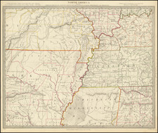
Detailed map of a 40-mile section of the Ohio River, extending from just west of Paducah, Kentucky, at the confluence of the Ohio River and the Tenessee River, to the area near America, Illinois, approximately two-thirds of the way to the confluence of the Ohio River and the Mississippi River.
Almost certainly prepared in early 1827 by George Armstrong, Deputy Surveyor for the State of Kentucky, the map is apparently one of two maps drawn by Armstrong, the second (dated April 30, 1819) residing in the collection of the Library of Congress (showing part of Louisville, Kentucky). The map was almost certainly prepared for William Clark, as it bears his faint signature and inscription above his name near the future town of Paducah, Kentucky, where he describes the favorable condition of the lands which would become part of the future town of Paducah.
The map details the division of a parcel of approximately 74,000 acres originally acquired by George Rogers Clark in 1795 from the Commonwealth of Virginia, pursuant to a Treasury Warrant. Clark had noted the spot as an ideal place for settlement as early as 1778, when he visited the area at the confluence of the Tennessee and Ohio Rivers during the early days of the American Revolution.
The area in question was the site of a number of important events prior to 1795. Fort Massac, shown on the north side of the River, was the location of the legendary fort that dates back as early as 1540, where some believe that the Spanish explorer Hernando de Soto constructed a primitive fortification. Fort Massac was built by the French in 1757. In 1794, during the Northwest Indian War, President George Washington ordered the fort rebuilt, and for the next 20 years it protected U.S. military and commercial interests in the Ohio Valley, becoming one of the primary locations for interdicting smugglers and spies, including the Kentucky conspirators in the Spanish Conspiracy, under the command of Zebulon Pike Sr. (whose son, Zebulon Pike, also served as a Cadet at Fort Massac in this period). Fort Massac was the site of the American arrest of the French spy, George-Henri-Victor Collot and the Spanish Spy Thomas Powers in 1796 (by Zebulon Pike Sr.). The Lewis and Clark Expedition stopped at Fort Massac on its way west, recruiting two volunteers. During the summer of 1805, former U.S. Vice President Aaron Burr and Gen. James Wilkinson met at Fort Massac where they allegedly drew up plans to conquer Mexico and the American southwest.
William Clark obtained title to the land in 1803 from Georges Rogers Clark in exchange for cancellation of a $2100 debt, a claim which George Rogers Clark's heirs would later dispute. The book, Old Kentucky Entries and Deeds, lists under both William Clark as Grantee and George Rogers Clark as Grantor a deed to 73,962 acres, dated July 28, 1803. A copy of this was obtained from the records. It reads in part:
This Indenture made this 28th day of July one thousand eight hundred and three between George Rogers Clark of the County of Jefferson and the Commonwealth of Kentucky of the one part and William Clark of the said County and State of the other part Witnesseth that the said George Rogers for and in consideration of the sum of twenty one hundred dollars (Sundry services by the said William) to him in hand paid by the said William . . . hath granted bargained and sold and by these presents do hereby grant bargain and sell and confirm unto the said William his heirs and assigns forever two certain tracts or parcels of land containing seventy three thousand nine hundred and sixty two acres more or less situated lying and being in the County of Livingston on the Ohio below the Tennessee River and bounded as follows . . .
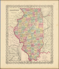
While settlers began entering the area at the beginning of the 19th Century, the land was not legally opened up to settlement until after the Jackson Purchase in 1818, which thereafter would become the unofficial name for this region. A boundary dispute between Kentucky and Tennessee further delayed the movement into the "Jackson Purchase" region until 1820; however, the genesis of Paducah suffered still more delay. A division of the Clark lands by lot was made by F. B. Bullett on April 20, 1823. However, conflicting claims among the Clark heirs caused uncertainty and dual claims; therefore, it was not until 1827 that William Clark had the town was platted, with the final plat drawn up by Robert Fletcher and recorded on June 18, 1830.
The map may have also been in the possession of George Woolfolk. During this time period, William Clark was living in St. Louis and retained Woolfolk to clear out the squatters on his land or sell them parcels. The map shows the future and still unnamed townsite of Paducah, Kentucky. Below the reserve, in the 12,000 acres labeled Wm Clark, a faint note appears which reads:
I lay off this 12000 acres as I may think proper to include good land & favourable situation above Hollingsworth.
Wm Clark
The primary landowners shown on the map total 91722.75 acres and are as follows:
Reserve 9882.75
Wm Clark 12000.00
Levi Hollingsworth 4016.50
Ann Gwathmey Heirs 1195.00
Jonathan Clark's Heirs 9421.00
Elizabeth Anderson's Heirs 10489.50
Lucy Croghan's Heirs 10489.50
Fanny Fitzhugh 5000.00
Levi Hollingsworth 4016.50
Dennis Fitzhugh Heirs 10498.50
Ann Gwathmey Heirs 9294.50
Jonathan Clark's Heirs 1068.50
Harry Innes 4350.50 (first Federal District Court Judge in Kentucky -- appointed in 1789)
Of note, Harry Innes, holder of the western parcel, was one of the primary co-conspirators with General James Wilkinson in the Spanish Conspiracy. Innes was one of several prominent Kentuckians who was paid 2,000 pieces of eight a year for several years by the Spanish as part of a scheme to induce Kentucky to secede from the United States and join or ally with Spain.
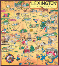
William Clark and Paducah, Kentucky
The site of present day Paducah was first acknowledged by Europeans when George Rogers Clark made a short stop at the mouth of the Tennessee on the Illinois shore in 1778.
On September 15, 1795, the Commonwealth of Virginia awarded General George Rogers Clark nearly seventy-four thousand acres of land in extreme western Kentucky, purportedly in appreciation of his military victories against the British at Kaskaskia, Cahokia, and Vincennes in the old Northwest Territory during the Revolutionary War, although the actual basis for the award has long been unsettled. It was a dubious compensation at the time, since Virginia did not own the land; it was Chickasaw hunting ground and would continue to be until the Jackson Purchase of 1818. In 1803, severely pressed by his creditors, the general yielded title to the land to his younger brother William "to cancel a $2,100 debt."
The land in question was part of the so-called "Jackson Purchase, a region of western Tennessee and southwestern Kentucky, bounded by the Tennessee River on the east, the Ohio River on the north, and the Mississippi River on the west, that was ceded to the United States by the Chickasaw Peoples in 1818. The land was ceded after prolonged negotiations in which the United States was represented by Andrew Jackson and Isaac Shelby, while the Chickasaws were represented by their chiefs, head men, and warriors including: Levi and George Colbert, Chinubby, and Tishomingo. On October 19, 1818, the two sides agreed to the transfer by signing the Treaty of Tuscaloosa. The United States agreed to pay the Chickasaws $300,000, at the rate of $20,000 annually for 15 years, in return for the right to all Chickasaw land east of the Mississippi River and north of the Mississippi state line. The treaty was ratified by the United States Senate and confirmed by President James Monroe on January 7, 1819.
Paducah, originally known as Pekin, was settled around 1815. the community was inhabited by a mix of Native Americans and Europeans who lived harmoniously, trading goods and services.
After serving as Governor of Missouri, President Monroe appointed William Clark surveyor general of Illinois, Missouri, and Arkansas, 1824-25. He also served as superintendent of Indian Affairs in St. Louis from 1822 to 1838. In 1827, as Superintendent of Indian Affairs for the Mississippi-Missouri region, Clark arrived in Pekin with a title deed to the land he now owned, which was issued by the United States Supreme Court. Clark most likely took stock of the settlers that had arrived at some point before himself, and offered the land for purchase, so they could occupy it with title in their name. If they did not choose to purchase the right to occupy the land, they most likely relocated to another domicile. The town was platted out and named in honor of the largest nation of Native Americans that ever roamed North America, the Padouca Indians. Lewis and Clark had made acquaintance with many of them while on their trek west.
On April 26, 1827, the following advertisement appeared in the St. Louis Missouri Republican:
PA-DU-CAH
At the mouth of the Tennessee river, situated on the bluff on the Ohio river, opposite the lower end of Tennessee Island. This place affords a perfectly safe steam boat landing, and can be visited by steam boats from New Orleans at all seasons of the year, is well situated for houses for the storage of the exports from, and the imports to the states of Tennessee and Alabama, at such times as the Tennessee river cannot be navigated by steam boats, and possesses numerous other advantages which it is deemed unnecessary here to enumerate. The undersigned has laid off about 100 acres in a town to be called PA-DU-CAH, in lots of suitable size, which will be sold to the highest bidders, at the place, on Saturday, the 26th day of May next, and continue from day to day until as many lots are sold as may be deemed necessary for the commencement of a town. They will be sold upon terms which will be made known on the day of sale. -- William Clark
Rarity
The map is apparently quite rare.
The map is very similar to a map in the collection of the Library of Congress, signed by George Armstrong, Jefferson County, Kentucky Deputy Surveyor.
The Filson Society holds what sounds like a similar map, described as:
Map of land in Kentucky along the Ohio River, west of the mouth of the Tennessee River, which is owned by George Rogers Clark and is to be inherited by Clark's heirs. The land is divided up in tracts ranging from approximately 400 acres to 12,000 acres. The map also lists the inheritor of each tract.
Provenance
Deaccessioned from the Dumbarton House Collection, Washington D.C.; Gifted to them by the Rhode Island Society of the Colonial Dames of America, 1930.


![(Southern Travel Journal) [Manuscript travel journal to Mobile, Alabama by Andrew Clark, Jr. of Methuen, Massachusetts, also by horseback through Kentucky and Tennessee and up the Mississippi north to Pittsburgh]](https://storage.googleapis.com/raremaps/img/small/93034.jpg)