With Prototype Maps for North America.
No title-page, manuscript index, and 129 maps (of 124 called for in manuscript index), 124 in original outline color.
Folio, period calf, gilt-stamped spine with raised bands, red morocco spine label. (Rubbed, some wear and loss at corners, slight splits at joints, a little loss to head and foot of spine, but binding quite sound.)
A French composite world atlas probably published by Pierre Moullart Sanson (d.1730), who took over the Sanson firm from his uncle, Guillaume Sanson, in 1692. Most of the maps have the imprint of Guillaume, or his father Nicholas Sanson, considered by many to be the founder of the French school of cartography. First published in 1658, Nicolas Sanson's Cartes Generales de toutes les parties du Monde, of which this atlas is an untitled variant, was the first folio French world atlas.
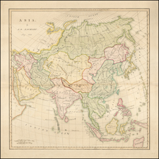
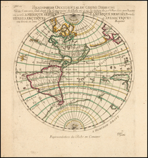
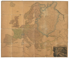
The index calls for 124 maps, but there are an additional five maps and charts, dated 1689-97, by Nicolas De Fer, C. Roussel, and Pierre Du Val that relate to the Nine Years War (1688-97) The remaining maps include three hemispheric world maps, a double-hemisphere of the polar regions, a celestial chart in full color, and five maps of the continents.
American Content
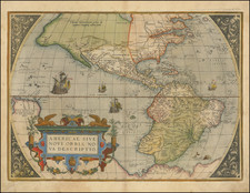
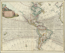
Thirteen maps relate to America. These include G. Sanson's 1690 map of North America; N. Sanson's Le Canada, 1656; and N. Sanson's Le Nouveau Mexique et la Floride, 1656.
The last two are foundation maps for the regional mapping of North America. Le Canada "would not be superseded" until the 18th century (Burden), and Nouveau Mexique et Floride introduced the standard form for depicting California as an island (the Sanson model).
The son of famous French cartographer Nicolas Sanson, Guillaume (1633-1703) carried on his father's work. Like his sire, he was a court geographer to Louis XIV. He often worked in partnership with another prominent cartographer of the time, Hubert Jaillot.
Nicholas Sanson (1600-1667) is considered the father of French cartography in its golden age from the mid-seventeenth century to the mid-eighteenth. Over the course of his career he produced over 300 maps; they are known for their clean style and extensive research. Sanson was largely responsible for beginning the shift of cartographic production and excellence from Amsterdam to Paris in the later-seventeenth century.
Sanson was born in Abbeville in Picardy. He made his first map at age twenty, a wall map of ancient Gaul. Upon moving to Paris, he gained the attention of Cardinal Richelieu, who made an introduction of Sanson to King Louis XIII. This led to Sanson's tutoring of the king and the granting of the title ingenieur-geographe du roi.
His success can be chalked up to his geographic and research skills, but also to his partnership with Pierre Mariette. Early in his career, Sanson worked primarily with the publisher Melchior Tavernier. Mariette purchased Tavernier’s business in 1644. Sanson worked with Mariette until 1657, when the latter died. Mariette’s son, also Pierre, helped to publish the Cartes générales de toutes les parties du monde (1658), Sanson' atlas and the first French world atlas.
![[ South America ] Tierra Nova](https://storage.googleapis.com/raremaps/img/small/94058.jpg)