|
||

|

|
|

|
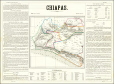
Remarkable, stylized, post-revolution map of mountain town San Adr és And úa
This is a striking topographic map of San Andrés Andúa in Oaxaca, México. The small town lies in the hills of the Sierra Madre de Oaxaca in southwestern Mexico. The modern population is only 248 with 103 dwellings, a figure likely only slightly higher than the town depicted on the map.
This map shows the hill which the town hugs; the village lies at 2,131 meters above sea level. The hill is illustrated by contour lines to show elevation, a style common since the late-eighteenth century. Rivers, marked in blue, run on either side. At the summit is a church surrounded by two larger buildings. Houses scatter down the hillside to the west. A table explains the symbols utilized in the map, including the red and brown dotted lines that denote the boundaries of adjoining parcels of land.
Surrounding the boundaries and contour lines, in the same geometric style of writing as the title, are the names of nearby settlements-Topiltepec, Tillo, Dolores, and Chindua. With the exception of Dolores, these towns still exist: San Pedro Topiltepec, Santiago Tillo, and San Francisco Chindua. They all follow the pattern of many Oaxacan settlements of carrying a Spanish name, usually a saint, followed by a Zapotec name. The toponyms themselves are markers of a colonial past.
A final detail of the plan is the signature, in a different style than the block letters of the titles. The inscription reads "Andua 4 de Agto de 1924 Ingeniero Miguel Figueroa." Mexico had been attempting to map its territory since the mid-nineteenth century, but the rural settlements and rough terrain made the project a slow one. Porfirio Diaz in particular, the dictator president who ruled Mexico from 1876 to 1911, sought to map his territory as part of his modernization campaign. By 1924, the upheaval of the popular revolt had died down, signaling the return to other projects, like mapping.
![(Mexican-Aztec Paintings) [Codex Cospi or Bologna] Aglio Mexican Antiquities. Facsimile of an Original Mexican Painting preserved in the Library of the Institute at Bologna, British M[useum]](https://storage.googleapis.com/raremaps/img/small/102339.jpg)
![(Mexican-Aztec Paintings) [Aztec Deities from the Codex Laud] Laud MSS (page 3). B65 nunc 678. Aglio 2 Vol.](https://storage.googleapis.com/raremaps/img/small/102323.jpg)
![(Humboldt Atlas and Text) Geographique et Physique du Royaume de Nouvelle-Espagne [with quarto text:] Essai Politique de la Royaume de la Nouvelle-Espagne](https://storage.googleapis.com/raremaps/img/small/99796.jpg)