|
||

|

|
|

|
Two outstanding regional maps of Africa.
The north sheet extends south to the Mountains of Kong or Mountains of the Moon. The Sahara Desert appears prominently, with the routes traversing the continent through the Sudan very much in evidence. The routes of Browne, Horneman, Bruce, and Park are shown, along with the Caravan Routes. The Southern map is also remarkably detailed and shows the extensive settlements and topographical details of the South. Campbell's route and return are shown.
A terrific pair of maps, illustrating the interest and explorations of the early 19th Century.
John Thomson (1777-ca. 1840) was a commercial map publisher active in Edinburgh. He specialized in guide books and atlases and is primarily known for his Atlas of Scotland (1832) and the New General Atlas, first published in 1817 and reissued for the next quarter century. The New General Atlas was a commercial success—it was also published in Dublin and London—and it compiled existing geographic knowledge in compelling ways for a wide audience.
His Atlas of Scotland introduced new geographic information and was the first large-scale atlas of Scotland to be organized by county. It provided the most-accurate view of Scotland available before the Clearances. Work on the atlas began in 1820 and led to Thomson’s bankruptcy in 1830 due to the high costs of gathering the latest surveys and reviewing the required materials. Despite the publication of the atlas, Thomson declared bankruptcy again in 1835.
![(Marakesh) Palatium Magni Regis Maroci In Barbaria [Palace of the Great King of Morocco in Barbary]](https://storage.googleapis.com/raremaps/img/small/53154.jpg)
![[False Bay] In de Baay Falso](https://storage.googleapis.com/raremaps/img/small/61861.jpg)
![[South Africa]. Charte der Sudspitze Africa und der Colonie vom Vorgebirgedernugen Hoffnung haputeschilich nach Barrow's Neuesten Reisen enworfen und nach astronomischen Ortsbestimungen. . . .1804](https://storage.googleapis.com/raremaps/img/small/47947.jpg)
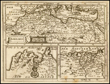
![[ Morocco ] Statuum Maroccanorum, Regnorum nempe Fessani, Maroccani, Tafiletanin et Segelomessani Secundum suas Provincias accurate divisorum, Typus generalis novus . . . 1728](https://storage.googleapis.com/raremaps/img/small/95640.jpg)