
This item has been sold, but you can enter your email address to be notified if another example becomes available.


|
||

|

|
|

|
Stock# 48173
Description
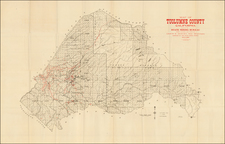
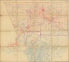
Official 1899 Postal Route Map for California and Nevada
Scarce and remarkably detailed late 19th Century Postal map of Nevada and California, issued by the United States Post Office.
Includes a large inset of the Los Angeles Basin and the Bay Area.
Two insets list the counties. The Explanation identifies the various mail services:
- Black: Railroads
- Grey: Mail Service 6 days per week
- Blue: 3 days per week
- Pink: 2 days per week
- Red: 1 day per week
- ....: Special Supply
A separate key for Mail Messengers and discontinued mail offices are noted, as are Electric and Cable Cars, along with Rural Free Delivery Routes.
Condition Description
4 sheets, unjoined. Housed in 2 maroon cloth covers, with gilt titles.
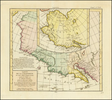
![La Parte Occidentale Dell'Antico, E Nuovo Messico Con Florida E La Bassa Luigiana…. 1798 [California & The Southwest!]](https://storage.googleapis.com/raremaps/img/small/95816.jpg)
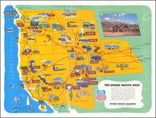
![For Governor, Maj. Gen. John W. Geary [Former Mayor of San Francisco / Governor of Kansas Territory and Governor of Pennsylvania]](https://storage.googleapis.com/raremaps/img/small/93592.jpg)