


|
||

|

|
|

|
Annotated To Show Proposed Improvements During the Hausmann era
Important 19th Century Plan of Paris, by Theodore Jacoubet.
The Jacoubet atlas of the city, the suburbs and monuments of Paris was made by the architect Theodore Jacoubet. The writing and engraving were done by J. M. Hacq and D. Bonnet.
Jacoubet is the last architect to have been responsible for the establishment of a map of Paris. The maps are significant because all streets and buildings are drawn to scale thereby making the maps extremely accurate for the time.
The atlas is a very large map of Paris in 54 sheets and was published between 1827 and 1836, delivered in 9 parts.
The present example is heavily annotated to show the evolution of the city planing, expansion of the roads and changes in the buildings. Many sheets have annotations showing proposed new streets, widening of streets, and new public spaces.
It is possible that this set was used in the early planning of the Haussmann designs for new wide boulevards that were constructed in the period 1853 to 1870. The new Opera house is shown in manuscript plan. Streets and roads, canals, public buildings and monuments are represented, some roads and monuments are anticipated by the architects: churches, opera house, the City Hall, for example, is shown as it will be completed in 1848.
This copy is with the bookplate of Paris historian and collector Paul Lacombe (1848-1921) who was librarian at the National Library, a noted bibliographer, member of the Society of Friends of the books and of the Society of French bibliophiles
![[ Holy Roman Empire ] Germania del Gastaldo](https://storage.googleapis.com/raremaps/img/small/73754.jpg)
![[La Rochelle] Rochella Munitissimum Galliae Opp.](https://storage.googleapis.com/raremaps/img/small/77250.jpg)
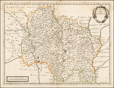
![Topographia aug. Turon[ensis] ducatus et confinium Galliae celticae sinu complectitur cuius latitudo ab aequinoctiali versus arcticum](https://storage.googleapis.com/raremaps/img/small/75142.jpg)