|
||

|

|
|

|
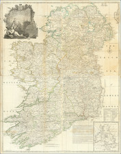
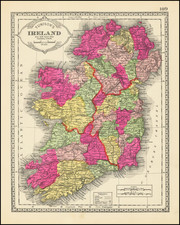
Early Facsimile Edition of William Webb's map of Ireleand from circa 1645.
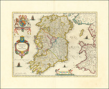
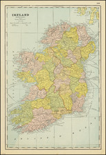
Facsimile map of Ireland, which appeared in the 1810 Dublin edition of Pacata Hibernia.
First published in London in 1633, the Pacata offers an impartial, contemporary account of affairs in Ireland during the latter stages of the Nine Years War, as well as details on the conduct of the campaign in Munster. The work also includes a series of accompanying maps.
Unlike the other maps in the Pacata, this map is not a direct copy of any previous known map. The geography is from a very rare map sold by William Webb in about 1645, but the title is new wording, placed at bottom right, whereas the original has a different title at top left. The Irish arms are new to this version.
The map depicts the 1641 rebellion, but the key to the symbols is omitted (towns taken by the rebels; besieged; burnt) - replaced by the new title.
Irish historian Standish O'Grady characterizes Pacata Hibernia as "the most famous of the Anglo-Irish historical classics". The author, Sir Thomas Stafford (1574-1655), was a secretary to Sir George Carew, the 1st Earl of Totnes. Believed to be the illegitimate son of Carew, Stafford also served under him as a captain in Munster during the campaign against Hugh O'Neill.
A large collection of manuscripts relating to Ireland were donated to Stafford by Carew at the time of the latter's death. While this collection would have acted as a primary source for his work, it is stated by Stafford that he also drew on Carew's own writings in composing his Pacata Hibernia.