
This item has been sold, but you can enter your email address to be notified if another example becomes available.


|
||

|

|
|

|
Stock# 44248
Description
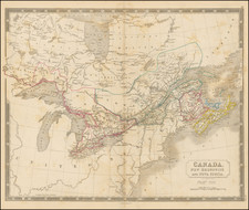
Detailed map of Canada, Maine and the Lake Champlain Region, published at the beginning of the American Revolution.
The map provides a finely detailed depiction of the St. Lawrence River and environs, from Montreal to Hare Island, along with the details on the coastline of Maine, noting an number of forts, including:
- Frank Fort
- Fort Richmond
- Ft. Frederick
- Ft. Western
- Ft. Halifax
- Ft. Chambly
- Ft. Sorez


![[ English Plantations in North America ] A New Map of the most Considerable Plantations of the English In America Dedicated to His Highness William Duke of Glocester.](https://storage.googleapis.com/raremaps/img/small/98233.jpg)