|
||

|

|
|

|
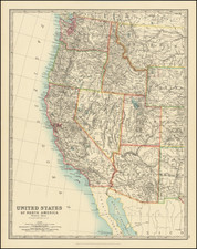
Fine map of the southern half of Arizona and New Mexico, focusing on the Indian Battles fought against Geronimo and the Chiricahua Indians in the summer of 1886.
The map covers all of Arizona and New Mexico south of 34 N, from Phoenix on the west to not quite Roswell on the east, northern Sonora to well below Hermosillo, and extreme west Texas.
At least 40 army forts, camps, and posts (some no longer in service) are located, as well as innumerable railroad whistle stops, ranches, and water holes.
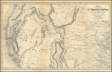
In late March, 1886, Geronimo and his small band surrendered, presumably for the last time, to Lt. Col. George F. Crook, but within days, they bolted back into Mexico, having been convinced by a lying American bootlegger that they would be murdered as soon as they crossed into U.S. territory. In 1886, Nelson A. Miles replaced Crook as commander of forces fighting against Geronimo in the Department of Arizona.
Crook had relied heavily on Apache scouts in his efforts to capture the Chiricahua leader. Instead, Miles relied on white troops, who eventually traveled 3,000 miles without success as they tracked Geronimo through the tortuous Sierra Madre Mountains. Finally, First Lieutenant Charles B. Gatewood, who had studied Apache ways, succeeded in negotiating a surrender, under the terms of which Geronimo and his followers agreed to spend two years in a Florida reservation. Geronimo agreed on these terms, being unaware of the real plot behind the negotiations (that there was no intent to let them go back in their native lands). The exile included even the Chiricahuas who had worked for the army, in violation of Miles' agreement with them.
![[Touring Map of California]](https://storage.googleapis.com/raremaps/img/small/76578.jpg)