This item has been sold, but you can enter your email address to be notified if another example becomes available.


|
||

|

|
|

|
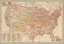
Stock# 2715
Description
A nice map of the United States, which includes the short-lived proposed State of Franklin, an early Tennasee [sic], the territory of Morgania (Missouri), Georgia extending to the Mississippi River and other early notes and ephemeral placenames. The map includes many forts, early Indian placenames and notes regarding various early treaties, boundary claims, charters, etc. The map has an added right margin with minor loss to the neatline which has been drawn in and other minor repairs. Nevertheless, an early and scarce example of several interesting and short-lived territorial and state names.