|
||

|

|
|

|
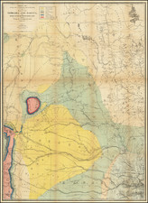
Detailed map of Mexico, including Texas, Upper California and the region west of the Mississippi River, prepared shortly after Humboldt's report.
The map provides a detailed look at Mexico, 10 years before its Independence from Spain. Texas is part of Potosi, with a number of towns and rivers shown. The provinces of Mexico are all separately colored, with New Mexico the most northern of the named provinces. North of the Gila River, there are multiple place names along the Rio Colorado and its Tributaries, including the location of the Spanish missions in the region.
The map extends north to Lake Timpanagos and a second unnamed lake, with a note indicating that its western limits ar unknown. The cuours of the Red River, Arkansas River and the Kansas River and its tributaries pre-date the more detailed information which would come from the Stephen Long Expedition into the region. The information learned from the expeditions sent out by Thomas Jefferson, including the Pike Expedition, the Dunbar Expediton and the Custis & Freeman Expedition.
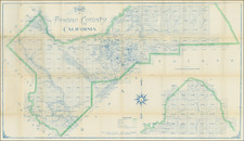
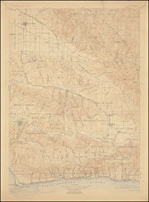
Interesting early map of the region, on the eve of the American push to explore the region.
John Cary (1755-1835) was a British cartographer and publisher best known for his clean engraving and distinct style which influenced the entire map industry. Born in Wiltshire, John was apprenticed to an engraver in London. He started his own business by 1782 and moved to several premises before settling at 86 St James’s Street in 1820.
Cary had several significant collaborations during his career. John Wallis and Cary diversified Cary’s business to include broader publishing projects. Brother William and John made globes together, while brother Francis participated in the company’s engraving work. Finally, geologist William Smith and Cary developed and sold geological maps, some of the first of their kind. The pair also produced a notable series of county maps starting in 1819. Cary’s atlases, of English counties and the world, were the standard texts of the early nineteenth century. He was appointed surveyor of roads to the General Post Office in 1794, which led to the New Itinerary, first published in 1798.
John trained his son, George, in engraving and George and his other son, John Jr., took over the business in 1821. It was then known as G. and J. Cary and continued in trade until 1850. The firm’s materials were then acquired by George Frederick Cruchley and then Gall and Inglis. By the time John died in 1835, Cary was the authoritative name in private map publishing and his business was a leader in the field throughout the first half of the nineteenth century.
![Amer. Sep. No. 71. Partie Du Mexique et de Guatemala [Oaxaca, Tabasco, Chiapa, Verapaz]](https://storage.googleapis.com/raremaps/img/small/96583.jpg)
![Gray's New Map of California [Yosemite & San Francisco insets]](https://storage.googleapis.com/raremaps/img/small/89713.jpg)