|
||

|

|
|

|
Important early South San Francisco land promotional map, printed for the South San Francisco Land & Improvement Company. The map is printed by Rand McNally for Earnshaw & Punshon, Surveyors and Landscape Engineers, Cincinnati, Ohio.
The map shows the original lay out of the town of South San Francisco, as designed by Earnshaw & Punshon, including the Stock Yards and commercial districts, which would be central to its development. The proposed route of the Southern Pacific Railway,San Bruno Train Station, Shore Street Railway are shown, along with the Race Track & Fair Grounds, hotel and depot for the Shore Street Railway. The Baden Railway Station appears in the east, at the junction of hte Southern Pacific Line and a second proposed line. At the north end of the town, the reserveroir is tucked into the hills, about Crocker Avenue.
North of the Town, Rancho Rincon De Las Salinas, Rancho Canada Guadalupe Rodeo Viejo y Visitacion and San Miguel Rancho are shown, largely undeveloped. The lines of the Spring Valley Flume are shown coming into San Francisco from the south.
A lengthy set of notes includes descriptions of the new city, including 6 paragraphs on "Why It Should Be Great", 3 paragraphs on "What is Aimed At," and and 4 paragraphs on "What it Is," including a succinct fourth paragraph, noting that "Being in San Mateo County, it enjoys very low taxation."
The map was prepared by the South San Francisco Improvement Company, formed by the American Cattle Trust to develop the region shortly after the land was purchased from the Miranda Lux in 1890. The city would be developed as a company town for its owners, with companies, including W.P. Fuller Paint, local steel mills, brick factories and the Western Meat Company.
The land which would become South San Francisco was originally primarily within Rancho Buri Buri. By 1810, a successful cattle grazing operation was being run within the Rancho. In 1890, the South San Francisco Land & Improvement Co. purchased 5000 acres of land, located in the northern part of San Mateo County, plotting the town of Baden, which would become as South San Francisco. In 1872, the Rancho was sold to a a number of different businessmen, including D. O. Mills, Ansel Easton and Charles Lux. With his newly acquired property Lux founded the town of Baden (northwest of modern-day South San Francisco) and purchased a number of the other neighboring parcels.
Just two years after Charles Lux consolidated the Rancho Buri Buri property, he formed a partnership with San Francisco butcher and entrepreneur Henry Miller. The two built one of the most powerful cattle businesses in nineteenth-century California. The prime grazing land of Rancho Buri Buri was ideal for holding cattle prior to slaughter, and Miller and Lux not only purchased more land within the former grant, but leased additional land on the Peninsula for grazing purposes. The pair bought significant land in the San Joaquin Valley and used the Rancho Buri Buri property as the final stop on the route to San Francisco.
When Charles Lux died, his wife Miranda sold his property in South San Francisco the American Cattle Trust of Chicago. In the early 1890s the American Cattle Trust was the nation's most powerful business conglomerate. The Cattle Trust formed the South San Francisco Land & Improvement Company in 1891 and created the Western Meat Company, a meatpacking firm. The South San Francisco Land & Improvement Co. began promoting the town of South San Francisco and the Western Meat Company was the first of many industrial concerns to be located at Point San Bruno.
No copies listed in OCLC. The only recorded example is in the collection of David Rumsey, who states that the date is estimated.
Rand McNally & Co. is a large American map and navigation company best known for its annual atlases. The company got its start in 1856, when William Rand opened a print shop in Chicago. He was joined in 1858 by a new employee, Andrew McNally. Together, the men established their namesake company in 1868. Originally, the company was intended to print the tickets and timetables for the trains running to and through Chicago; their first railway guide was published in 1869.
By 1870, they had shifted from just printing to publishing directories, travel guides, and newspapers. Their first map appeared in 1872 in a railway guide. The map was produced using a new wax engraving method, a cheaper process that gave the company an edge.
By 1880 Rand McNally had entered the education market with globes, wall maps, and geography texts for students. In 1923, Rand McNally published the first Goode’s World Atlas, named after its editor, Dr. J. Paul Goode. For generations afterward, this would be the standard classroom atlas.
In 1899, William Rand left the company, but McNally and his family remained, controlling the company for over a century. In 1904, they published their first road map intended for automobiles and by 1907 were publishing Photo-Auto Guides, which combined photography and mapping to help drivers. In 1924, they produced the Auto Chum, a precursor to their famous road atlases. Rand McNally would remain the leader in road maps and atlases throughout the twentieth century.
In 1937, Rand McNally opened its first store in New York City. Ever on the frontier of technology, Rand McNally pioneered the scribing process for printing tickets in 1958 and printed their first full-color road atlas in 1960. Arthur Robinson developed his now-famous projection of Rand McNally in 1969. By the 1980s, the company was exploring digital reproduction and digital databases of maps for truckers. In the 1990s, they lead the charge to develop trip-planning software and websites. Today, most of its products are available online or in a digital format, including maps for tablets and phones.
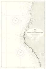
![[ Mapping an Historic Rainfall Event in Southern California ] Isohyetal Map of Northwestern Part of Southern California Showing total precipitation, in inches, February 27 to March 4, 1938](https://storage.googleapis.com/raremaps/img/small/82484.jpg)