|
||

|

|
|

|
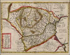
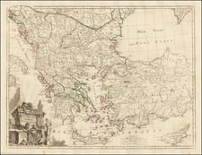
Unjoined 2 sheet example of the excellent map of the Balkans, from Bosniae to Bulgaria, following the course of the Danube and the lower Sau Rivers.
The map was originally prepared by Johann Friedrich Ottinger. The panels, at sides and at bottom, with 15 views and plans. Covers the theater of war between the Austro-Hungarian Empire under Charles VI and the Ottoman Empire under Achmet IV. The towns shown are Ussitza, Brodt, Wihaz, Zwornek, Ratscha, Sabatz, Belgrad, Orsava, Widden, Nicopolis, Nissa, Chatchek, Searglio, Krakoivaz,and Valiova.
Homann Heirs was a German publishing firm that enjoyed a major place in the European map market throughout the eighteenth century. Founded in 1702 by Johann Baptist Homann, the business passed to his son, Christoph, upon Johann’s death in 1724. Christoph died in 1730, aged only 27, and the firm was inherited by subsequent Homann heirs. This altered the name of the company, which was known as Homann Erben, or Homann heirs. The firm continued in business until 1848.