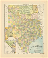
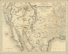
|
||

|

|
|

|
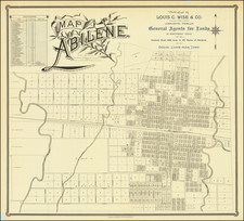
Nice example of Clark & Court's map of Dallas, Texas, an early separately issued map of the City.
Identifies Electric Railways, Steam Railways, Streets and Street numbers, City Limits, parks, public schools, fire stations, and public works, many of which are keyed to the accompanying index guide. Shows the names of a number of early subdivisions. The map is annotated in blue pencil to note the voting (?) districts and "members in business."
The map was published by Clarke & Courts, on what is believed to be the oldest lithographic printing press in the State of Texas. Clarke and Courts traces its roots to M. Strickland and Company, organized at Galveston by Miles Strickland in 1857. Strickland moved his printing press to Houston, but subsequently returned to Galveston. Robert Clarke became a partner in the firm in 1870. In 1877, George M. Courts purchased Strickland's interest. In 1877, the two printers brought the first lithograph press in the state to Galveston.
OCLC locates 3 examples (Yale, SMU, Hardin-Simmons).
![Mexico [Texas on the Eve of Independence]](https://storage.googleapis.com/raremaps/img/small/84917.jpg)
![The North Coast of the Gulf of Mexico from St. Marks to Galveston . . . 1844 . . . Additions to 1856, including the Surveys of Comr. Powell, Lt. Simmes & Profr. Coffin, U.S. Navy [and] St. Marks to Galveston. Sheet II. . . . 1845. Additions to 1851 . . . .](https://storage.googleapis.com/raremaps/img/small/89497.jpg)
![Mapa et tierra q[u]e yos pedro Vial taigo transitau en St. Tafee este dia 18 de Octubre de La ao 1787](https://storage.googleapis.com/raremaps/img/small/3645.jpg)