|
||

|

|
|

|
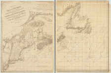
Rare German edition of Carey & Lea's map of Massachusetts. Shows early counties, roads, towns and a host of other details.
Carey & Lea published their monumental Geographical, Statistical and Historical Atlas of North America in 1822. The atlas was a commercial success and was re-issued in 1823 and 1827. It adopted the style of the Lavoisne Historical Atlas, which had been published in London and later in Philadephia by Carey & Lea, with descriptive text on two or three sides of the maps, rather than on the verso or other pages.
A French edition of the Atlas was published by Buchon in Paris in 1825. This German edition by Weiland is by far the rarest. All of the maps have been re-engraved by the Weimar Geographischen Insitut, a well regarded cartographic publisher. The engraving quality of the maps in this edition far surpasses the American edition. Weiland actually added several maps which did not appear in the Carey & Lea or Buchon additions. One of the earliest and rarest maps of the state printed outside the US.
![[Special Promotional / Sample Map for Rand McNally Business Atlas] Massachusetts](https://storage.googleapis.com/raremaps/img/small/89042.jpg)