|
||

|

|
|

|
A nice example of this scarce Ottens map of America and Oceana. California is shown as an island, based upon Sanson's model. The Great Lakes are shown with an open western coastline The Straits of Anian are shown, with no Northwestern Coast beyond 40 degrees. A mythical Terra Esonis is shown extending nearly to California. The seven cities of Cibola appear in the Southwestern US. The conception of the Mississippi River is still very vague and pushed far west of its true mouth. The large lake in the Southeastern US first seen on Le Moyne's map is still present. South America retains its excessively wide format. A hopeful extension from Button's Bay is shown portending a possible Northwest Passage. In Oceana, Quiri Regio foretells an early Australian coastline.
The map is rembellished with an elaborate cartouche and vignettes of native villages and warriors. While De Wit's name appears on the map, there is some question as to whether the map was based upon the De Wit edition or the much rarer Justus Danckerts edition of the map. As with the Danckerts, this edition is rarely seen on the market and was unknown to Tooley and Leighley.
The Ottens brothers, Reiner and Joshua, operated a successful printing partnership in the mid-eighteenth century (fl. 1726-1765). They began the venture in 1726, publishing maps and other prints as “R & I Ottens.” They specialized in the reprinting of others’ work, especially Guillaume De L’Isle. In 1750, Reiner died; his soon, also Reiner, took his place, but the firm began listing their works as “Joshua & Reiner Ottens.” The firm lasted until Joshua’s death in 1765. Joshua’s widow, Johanna de Lindt, sold their remaining stock of plates in 1784.

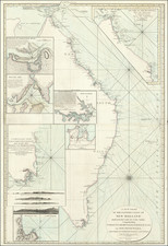
![(Tasmania) A Chart of van Diemen's Land, the South Extremity of New Holland [on sheet with:] Continuation o fthe River from King George's Bay, on a larger Scale. with the Situation of the Ships Duke and Duchess, at Anchor.](https://storage.googleapis.com/raremaps/img/small/94750.jpg)