|
||

|

|
|

|
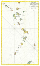
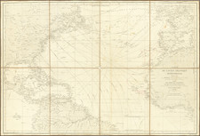
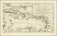
Nice old color example of Doncker's map chart of Puerto Rico, the Virgin Island and the Antilles, reaching to Trinidad and the Venezuelan Coast. One of the earliest obtainable sea charts of the region and quite scarce. On the verso, there are three manuscript profiles, annotated in English. The bottom profile references an approach to Anteagua (Antigua). The middle profile references Montsuratt (Monserat). We were not able to identify the top profile. A marvelous early sea chart, with what appears to be contemporary annotations on the verso in English, at a very early period for English trade in the Antilles and suggesting that the chart was probably used at sea in the 17th Century by and English vessel.
Hendrik Doncker was a prominent bookseller in Amsterdam best known for his sea charts and nautical atlases. He issued his own original charts, which he updated frequently, and also worked with colleagues like Pieter Goos, for example to produce the pilot guide, De Zeespeigel. He died in 1699, after fifty years in business. His plates then passed to Johannes van Keulen.