
This item has been sold, but you can enter your email address to be notified if another example becomes available.


|
||

|

|
|

|
Stock# 1140p
Description
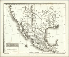
Scarce early map of the Western United States, showing marvelous early Territorial configurations. Washington & Oregon run to the Rocky Mountains. Nebraska extends to Canada and the Rocky Mountains. Kansas extends from the Missouri River to the Rocky Mountains. Oddly configured Dacotah Territory. New Mexico is above Arizona (Baylor Line) and Nevada has just appeared, although it is pushed east to Salt Lake and truncated the bottom. Many early Western Counties area lso named. The map includes numerous towns, forts, Indian Villages, early roads and exploration routes, an a host of other details. A nice example of the map, one of the best large format maps of the Western US on the eve of the Civil War.
![[California, Texas, and Southwest Globe Gore] with [Strait of Anian Globe Gore]](https://storage.googleapis.com/raremaps/img/small/99425.jpg)
