


|
||

|

|
|

|
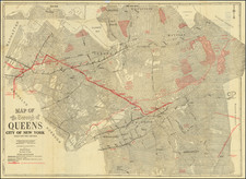
Rare (Unrecorded?) Second State -- Adding the 15th Ward of New York City
Rare second state of this meticulously detailed map, which captures the burgeoning urban landscape of New York City as envisioned by its city planners. Entitled Plan of the City of New York and of the Island as Laid Out by the Commissioners Altered and Arranged to the Present Time, this map provides an intricate portrayal of Manhattan Island, highlighting its streets, plots, and significant public buildings, with a large inset map at the top left extending the map further north. It reflects the ambitious grid plan proposed by the Commissioners' Plan of 1811, which aimed to organize the city's chaotic growth by imposing a structured street layout that would accommodate future expansion.
The map offers a comprehensive view of the city's streets and avenues, systematically numbered and arranged to illustrate the orderly progression of urban development. Prominent green spaces, such as the Parade, the Harlem Commons, and the Union Place, punctuate the grid, providing much-needed areas of recreation and public assembly amidst the dense urban fabric. Additionally, the map includes a detailed index that identifies 200 buildings and public places, ranging from government buildings and educational institutions to churches and markets, thereby serving as a valuable resource for understanding the civic infrastructure of early 19th-century New York.
Colored in an early hand, the map identifies the boundaries of 15 early wards.
Historically, this map is significant as it encapsulates the vision of urban planners who sought to transform New York into a modern metropolis. The Commissioners' Plan of 1811 was a revolutionary concept that aimed to preemptively manage the city's growth, ensuring that it could handle the influx of residents and businesses without descending into disorganized chaos.
States of the Map
At the time the map was originally published in 1828, New York City had 14 wards. The present example updates the first state by splitting the 9th Ward, to create a 15th ward from the eastern half of the 9th Ward.
This map, published in 1832, reveals how the initial vision had been altered and adapted to the evolving needs of the city, reflecting both the ambitions and the practicalities faced by urban developers of the time.
Goodrich also issued the larger so-called "Goodrich Plan" (A Map of the city of New York . . ) in 1827 and a smaller map of New York City between 1824 and 1833 in partnership with William Hooker.
Rarity
The present map is unrecorded by Haskell and OCLC.
The first state (1828) is rare on the market, with only a single example offered for sale in dealer catalogs reported by RBH (High Ridge Books, June 2001, Lot #29) and one example (this example) at auction at PBA Galleries in 2024 (mislabeled 1828).
Provenance: Bookplate of Charles George Moller Jr. (1844-1917).
![[Gustave Eiffel's Drawings and Blueprints for the Statue of Liberty]](https://storage.googleapis.com/raremaps/img/small/58964.jpg)
![[ Manhattan Island / New York City ] To His Excellency Sr. Henry Moore Bart. Captain General and Governour in Chief in & over the Province of New York and the Territories . . . This Plan of the City of New York and its Environs, Surveyed and Laid Down: Is most Humbly Dedicated . . . B. Ratzer](https://storage.googleapis.com/raremaps/img/small/105080.jpg)