|
||

|

|
|

|
Fine early pocket map of Nevada, colored by counties, and showing the extent of the township surveys to date.
This 1914 map of Nevada, colored by counties, provides a detailed and vivid representation of the state's administrative divisions at the time. Each county is distinctly shaded, allowing for easy differentiation and a clear understanding of the geographical boundaries within the state. The map includes key cities, towns, and the extensive railroad network that was crucial to Nevada's development in the early 20th century.
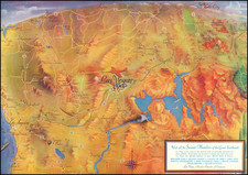
In the early 20th century, Nevada experienced significant growth and transformation. Following its admission to the Union in 1864, the state initially thrived on its rich mineral resources, particularly silver and gold. However, by the turn of the century, these resources began to dwindle, leading to economic fluctuations. The early 1900s saw a resurgence in mining with the discovery of new gold and silver deposits, particularly in places like Tonopah and Goldfield, which spurred economic growth and population influx.
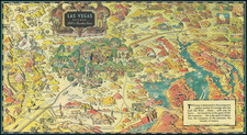
The completion and expansion of railroads played a pivotal role in Nevada's development during this period. Railroads facilitated the transportation of minerals, goods, and people, connecting remote mining towns with larger markets and encouraging settlement and commerce. This era also marked the rise of Las Vegas, which would later become a major urban center.
The map includes several significant railroads that operated in Nevada during this period, as indicated in the attached image:
- Atchison, Topeka & Santa Fe
- Eureka Nevada
- Las Vegas & Tonopah
- Nevada-California-Oregon
- Nevada Central
- Nevada Copper Belt
- Nevada Northern
- San Pedro, Los Angeles & Salt Lake
- Silver Peak
- Southern Pacific Co.
- Tonopah & Goldfield
- Tonopah & Tidewater
- Virginia & Truckee
- Western Pacific
These railroads not only contributed to the economic revival of Nevada but also laid the foundation for the state's future growth, transforming it from a primarily mining-based economy to a more diversified one. The map serves as a historical document, capturing the intricate network of railways that were instrumental in shaping Nevada's early 20th-century landscape.
![[Beatty - Nevada Mining Boom Town] Plat of the Townsite of Beatty Nevada . . . .](https://storage.googleapis.com/raremaps/img/small/53187.jpg)