|
||

|

|
|

|
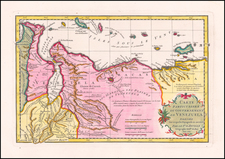
Stock# 103834
Description
Detailed early map of the coast of Venezuela and contiguous islands (Curacao, Bonaire, Aruba, Tortuga, Trinidad, Tobago, etc.)
The map was issued 3 years after 7 of the 10 provinces of the Captaincy General of Venezuela declared its indendence from Spain on July 5, 1811.
More specifically, the map was issued shortly after the campaign of 1813 established the so-called Second Republic, following the retaking of Caracas by an army led by Simon Bolivar on Agust 6, 1813.
Condition Description
Engraving on 19th-century laid paper. Original hand-coloring. Minor offsetting. Some very minor toning to the centerfold.
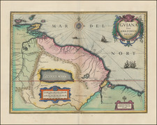
![[ El Dorado! ] Guiana in Guianam & Caribanam divisa. Per N. Sanson](https://storage.googleapis.com/raremaps/img/small/97909.jpg)