|
||

|

|
|

|
Stock# 103315
Description
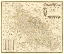
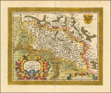
The map shows the region east of Tarnow and the Dunajec river, extending east to Zboriv, including parts of today's Poland and Ukraine.
Shows rivers, roads, towns, castles, forests, lakes and a host of other details. Quite possibly the most detailed map of this region to appear in an 18th Century Atlas.
From Von Reilly's exceedingly scarce Schauplatz der funf Theile der Welt. Von Reilley and Schraembl led a revival of map making in Vienna in the late 18th century which included this and several other sought after works.
Condition Description
Copperplate engraving on 18th-century laid paper. Original hand-coloring. Stain in upper blank border not affecting the map image.