|
||

|

|
|

|
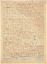
Interesting map detailing the geographical extent and linguistic landscape of the Southern and Central Yokuts territories, which illustrated the 1925 Handbook of the Indians of California, by Alfred Louis Kroeber.
The Yokuts, an indigenous people primarily located in what is now California, were divided into dozens of tribes, each speaking different dialects of the Yokuts language. This map is an invaluable document, shedding light on the intricate social and geographical organization of the Yokuts before significant European-American influence.
The map demarcates various essential aspects of Yokuts life and territory. The solid lines represent the territorial boundaries of the Yokuts, encasing the heartlands of this indigenous group. The dashed lines delineate the different dialects within the Yokuts language, indicating the rich linguistic diversity that existed among the tribes. Additionally, the dot-dash lines signify "Alien Divisions," possibly representing areas inhabited by non-Yokuts tribes or significant geographical divisions not strictly within Yokuts control.
Tribal locations are marked by symbols, presumably identifying the central villages or key areas of each tribe. The notation that "Alien Villages are given with their Yokuts names" suggests a comprehensive cultural mapping, acknowledging the presence and significance of neighboring groups within the Yokuts' geographic and social sphere.
This map serves as a scholarly resource, providing insight into the pre-colonial dynamics, settlements, and linguistic segmentation of the Yokuts. It paints a picture of a complex network of communities, each with its distinct identity yet sharing a common geographical and cultural landscape.
The Yokuts themselves were a diverse and multifaceted people, known for their intricate basketry, fishing and hunting skills, and rich oral traditions. Inhabiting the fertile San Joaquin Valley and the surrounding foothills and mountains, they developed a lifestyle intricately linked to the land's abundant natural resources. The map reflects the dispersion of the Yokuts across varied environments, from riverine systems to rugged hill zones, showcasing their adaptability and deep connection to their territory.
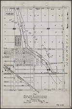
![[Santa Cruz / Holmes Lime Company] [H.T. Holmes Lot. Area 15 85/100 Acres.](https://storage.googleapis.com/raremaps/img/small/76542.jpg)
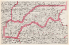
![[Southern California and Southern Nevada] Asher & Adams' California & Nevada, South Portion](https://storage.googleapis.com/raremaps/img/small/92086.jpg)