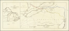
|
||

|

|
|

|
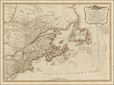
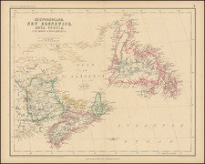
A scarce antique map of eastern Canada from Rogers & Johnston's Atlas of the United States, one of the most attractive American atlases of the 19th century.
This atlas was an unusual collaboration between an American, Englishman, and Scot. The map is a fragment of Rogers & Johnston's excellent and equally rare wall map. The map names counties, towns, rivers, and more. The evolution of the Rogers & Johnston work extends to 1873 when a modified example of the wall map was issued in Atlas form, first as the People's Pictorial Atlas by J. David Williams and later as the Jones Historical Atlas, two of the rarer and more interesting late 19th century American works. An important rarity for map collectors of this region.
This example shows New Brunswick, Nova Scotia, Newfoundland, as well as several smaller islands and provinces, including the French territories of St. Pierre and Miquelon.