


|
||

|

|
|

|
Interesting pictorial map of the vicinity of Palm Springs, California, illustrating various geographical and man-made features, providing a historical snapshot of the region.
The map is artistically rendered, depicting the rugged topography characteristic of the Palm Springs area and its surrounding regions. Mountain ranges, valleys, and flatlands are skillfully illustrated, emphasizing the natural beauty and varied landscape of the area. The San Jacinto Mountains, prominently featured, highlight the region's significant elevation changes and natural landmarks.
Palm Springs is centrally positioned, acting as the focal point of the map. Surrounding towns and areas such as Indio, Coachella, Cathedral City, and Desert Hot Springs are also labeled, offering context to Palm Springs’ location within the greater Coachella Valley. The map extends to include areas further afield, such as Beaumont, Hemet, and the Morongo Valley, providing a broader understanding of the region's geography.
Includes a plan of the city of Palm Springs on the verso.
![[Corona Del Mar]](https://storage.googleapis.com/raremaps/img/small/66927.jpg)
![[Santa Barbara] Map of the Eddy Tract Santa Barbara, Cal. Dec. 1887](https://storage.googleapis.com/raremaps/img/small/81703.jpg)
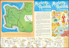
![[Monterey Peninsula Street Map]](https://storage.googleapis.com/raremaps/img/small/81426.jpg)