This item has been sold, but you can enter your email address to be notified if another example becomes available.


|
||

|

|
|

|
Stock# 101055
Description
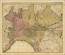
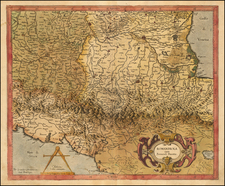
Attractive 18th-century map of northeastern Italy, focused on Venice, but encompassing Ferrara, Verona, Mantua, Parma, several of the Italian lakes, and extending to the west coast of Istria.
The map was published in Venice by Giovanni Antonio Remondini after having been first published by Paolo Santini in 1776.
Condition Description
Original hand-color in outline. A few small splatter stains. Small, faint stain in the Adriatic.
Paolo Santini Biography
Paolo Santini (1729-1793) was an Venetian engraver known especially for his religious prints and fine cartographic engravings. He published in Venice and may have a been a member of the clergy. In his maps, he largely adopted and adapted the work of his French counterparts, especially the brothers de Vaugondy.
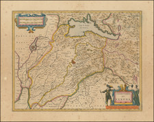
![[ Istria, Sloveniam, Northern Croatia ] Karstia, Carniola Histria et Windorum Marchia](https://storage.googleapis.com/raremaps/img/small/95562.jpg)