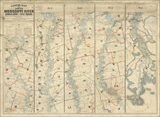
|
||

|

|
|

|
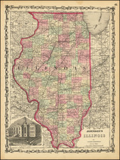
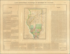
Gorgeous large-format railroad map of Illinois, hand-colored by counties. Only towns and cities that are on railroad lines are shown. Detail extends into Minnesota, Ohio, Iowa, and Missouri.
The map shows railroads, towns, rivers, lakes, mountains, township surveys, and more. This was published as part of the Asher & Adams Atlas, which was conceived to serve the purpose of being a Railroad Atlas.
Asher & Adams was a New York publishing firm known for their atlases. Notably, their maps were some of the first to prominently exhibit railroad lines, even if this meant a slight reduction in topographical detail. They specialized especially in state and county maps of the United States.
Asher & Adams was a New York publishing firm known for their atlases. Notably, their maps were some of the first to prominently exhibit railroad lines, even if this meant a slight reduction in topographical detail. They specialized especially in state and county maps of the United States.