
This item has been sold, but you can enter your email address to be notified if another example becomes available.


|
||

|

|
|

|
Stock# 0041bm
Description
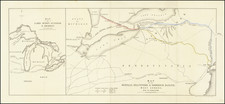
Gorgeous example of this early map of Wisconsin, issued 4 years after it became a Territory in 1836.
The lands south of the Wisconsin and Fox Rivers are largely surveyed and many early counties, towns, etc. appear. The region to the north is dominated with a massive Crawford County and St. Croix Counties. These lands of the Winnebagos, Menomonies, Oneidas, Sioux New York and Chippewa Indians are shown prominently. Massive Carver claim remains, now nearly 100 years old.
The south is filled with roads, and towns, the north rivers, portages, etc. One of the best early maps of Wisconsin in full original color.

![[ Karte des Nordens von America, Zur Beurtheilung der Wahrscheinlichkeit einer nord=westlichen Durchfhart, gezeichnet von G. Forster, 1791.]](https://storage.googleapis.com/raremaps/img/small/41816dm.jpg)
