
Search
Place/Date:
Brussels / 1825
Size:
20 x 18 inches
Condition:
VG
Stock#:
19806
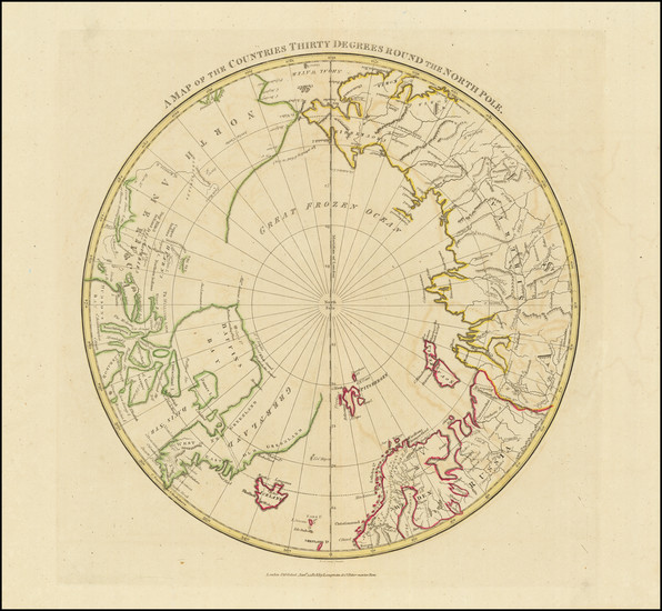
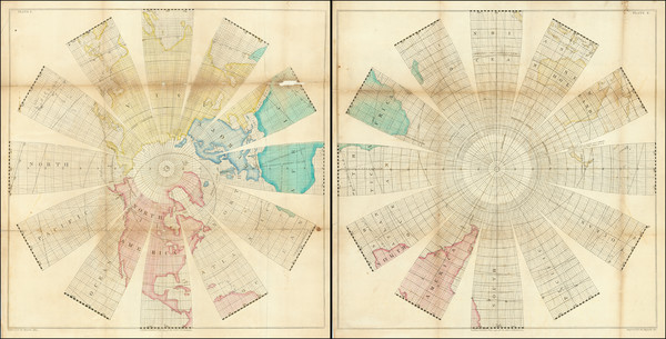
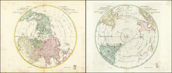
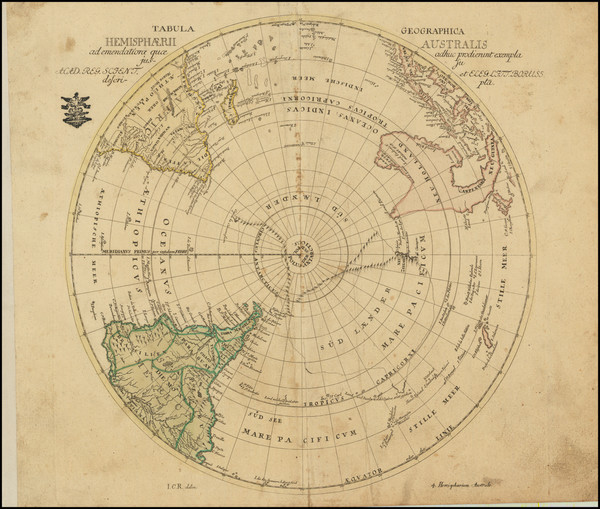
1825 antique Vandermaelen map showing Antique Polar Maps.
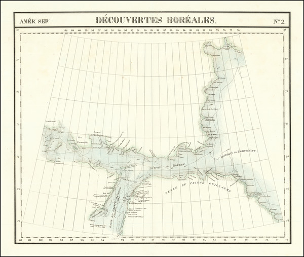
Place/Date:
Brussels / 1825
Size:
20 x 18 inches
Condition:
VG
Stock#:
19824
Vandermaelen's 1825 original map showing Antique Polar Maps.
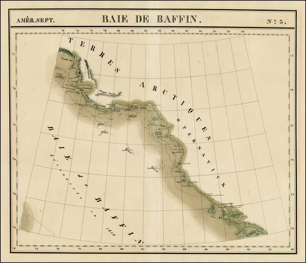
Place/Date:
Brussels / 1825
Size:
20 x 18 inches
Condition:
VG+
Stock#:
1785RB
Vandermaelen's 1825 rare map showing Antique Polar Maps.
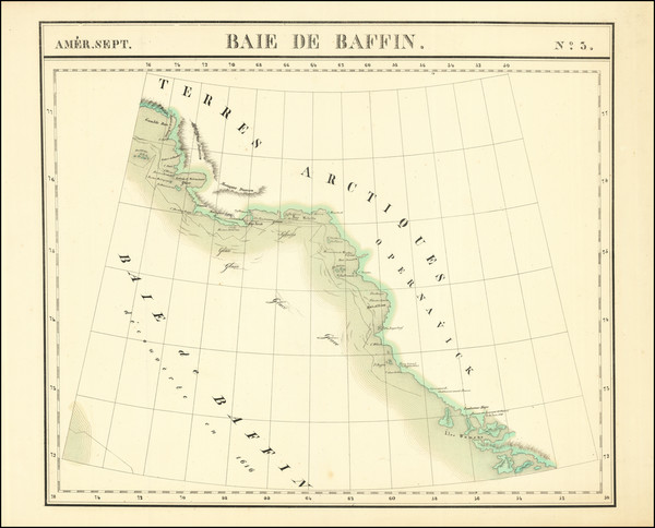
Place/Date:
Brussels / 1825
Size:
20 x 18 inches
Condition:
VG
Stock#:
1793RB
Vandermaelen's 1825 rare map showing Antique Polar Maps.
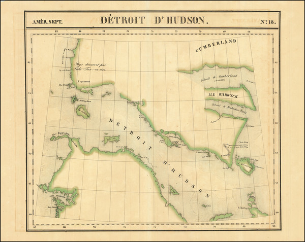
Place/Date:
Brussels / 1825
Size:
20 x 18 inches
Condition:
VG+
Stock#:
1795RB
Vandermaelen's 1825 antique map showing Antique Polar Maps.
Place/Date:
Brussels / 1825
Size:
22.5 x 19 inches
Condition:
VG+
Stock#:
78630
Place/Date:
Brussels / 1825
Size:
23 x 19.5 inches
Condition:
VG+
Stock#:
87865
Place/Date:
Brussels / 1825
Size:
22 x 18.5 inches
Condition:
VG
Stock#:
96886
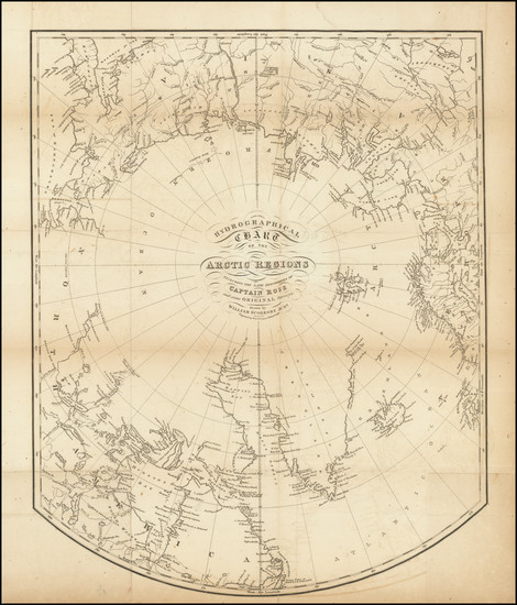
Place/Date:
London / 1824
Size:
24 x 16.5 inches
Condition:
VG
Stock#:
26460
Antique map showing Antique Polar Maps by Parry, 1824.
Place/Date:
Edinburgh / 1820
Size:
14.5 x 18 inches
Condition:
VG
Stock#:
91973

Place/Date:
Edinburgh / 1816
Size:
21 x 18 inches
Condition:
VG
Stock#:
73138
Place/Date:
Edinburgh / 1814
Size:
20 x 21 inches
Condition:
Stock#:
80331
Place/Date:
Philidelphia / 1814
Size:
10 x 10 inches
Condition:
VG+
Stock#:
89014

Place/Date:
Philadelphia / 1814
Size:
11 x 8 inches
Condition:
VG
Stock#:
89052
Place/Date:
London / 1808
Size:
14 x 14 inches
Condition:
VG
Stock#:
79051
Place/Date:
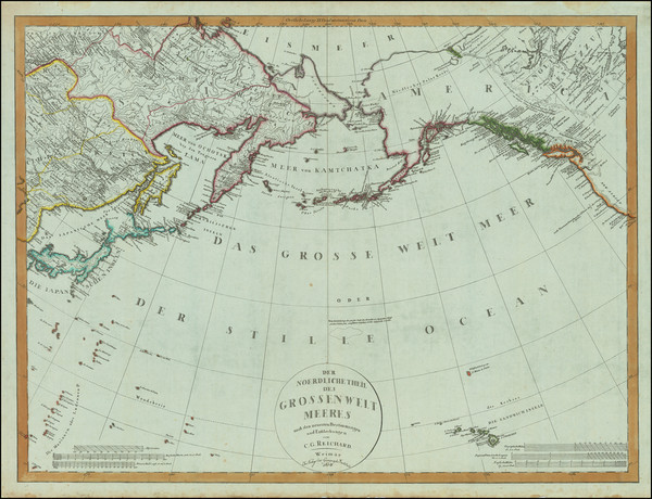
Weimar / 1804
Size:
26.5 x 20 inches
Condition:
VG+
Stock#:
80463
Place/Date:
Paris / 1802
Size:
22 x 23.5 inches
Condition:
VG
Stock#:
103457

Place/Date:
Nuremberg / 1800 circa
Size:
8.5 x 8.5 inches
Condition:
VG+
Stock#:
46375
Antique map showing Antique Polar Maps by Klinger made in 1800.
Place/Date:
Philadelphia / 1794
Size:
11 x 8 inches
Condition:
VG
Stock#:
69994

Place/Date:
Vienna / 1794
Size:
11 x 9 inches
Condition:
Good
Stock#:
80308
Place/Date:
London / 1794
Size:
23.5 x 23.5 inches (each sheet)
Condition:
Good
Stock#:
99920
Place/Date:
Berlin / 1791
Size:
25 x 19 inches
Condition:
VG
Stock#:
41816dm
Forster's 1791 antique map showing Antique Polar Maps.
Place/Date:
Amsterdam / 1790 circa
Size:
17 x 10 inches
Condition:
VG+
Stock#:
38194
Elwe's 1790 rare map showing Antique Polar Maps.
Place/Date:
Augsburg / 1787
Size:
9 x 7.5 inches
Condition:
VG
Stock#:
18651
1787 original Walch map showing Antique Polar Maps.
Place/Date:
London / 1787
Size:
17 x 11 inches
Condition:
VG
Stock#:
57281
Hervey's 1787 original map showing Antique Polar Maps.
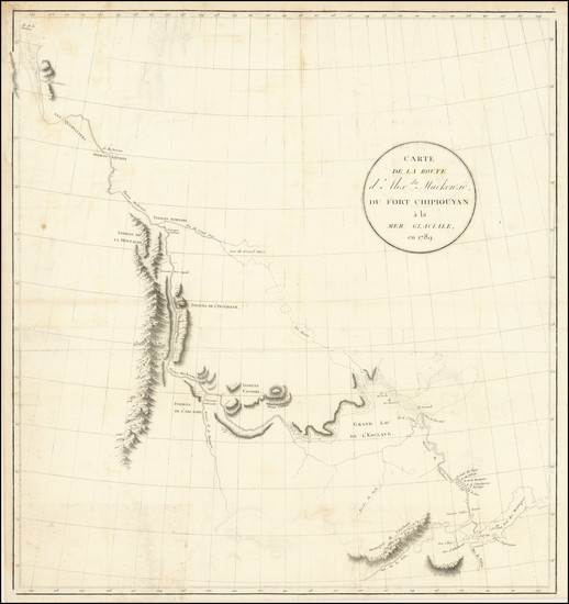
Place/Date:
Paris / 1780
Size:
25.5 x 18.5 inches
Condition:
VG+
Stock#:
78451

Place/Date:
London / 1778 circa
Size:
12 x 8 inches
Condition:
VG
Stock#:
39682
Middleton's 1778 antique map showing Antique Polar Maps.
Place/Date:
Paris / 1778
Size:
17.5 x 9 inches
Condition:
VG
Stock#:
95130
Place/Date:
Paris / 1776
Size:
35 x 22.5 inches Including Text
Condition:
VG
Stock#:
79970
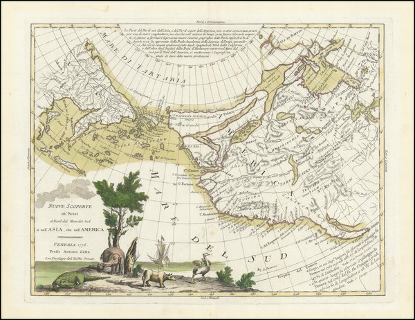
Place/Date:
Venice / 1776
Size:
16 x 12 inches
Condition:
VG+
Stock#:
101875
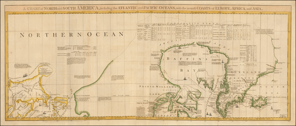
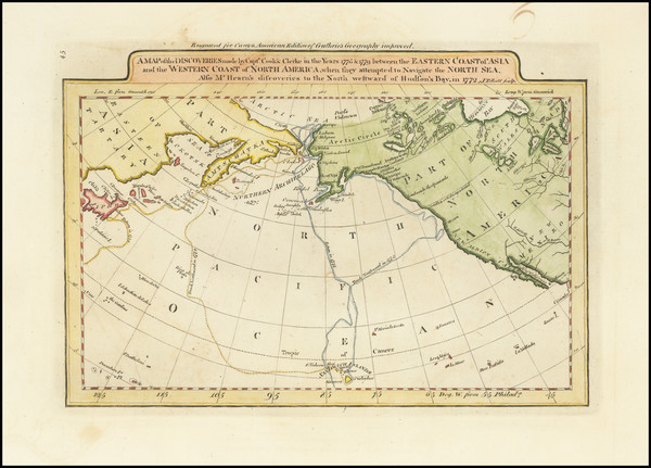
Place/Date:
London / 1775
Size:
19 x 44 inches
Condition:
VG
Stock#:
0002dg
1775 rare Sayer & Bennett map showing Antique Polar Maps.
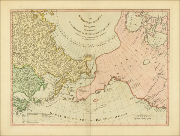
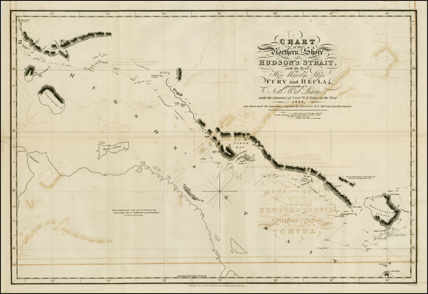
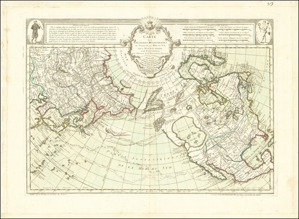
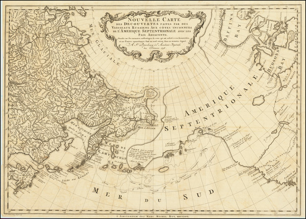
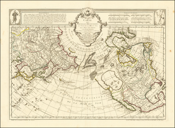
The Russian Discoveries, from the Map Published by the Imperial Academy of St. Petersburg . . . 1775
Place/Date:
London / 1775
Size:
24 x 18 inches
Condition:
VG
Stock#:
81950

Place/Date:
London / 1775
Size:
27.5 x 20.5 inches
Condition:
VG
Stock#:
96126
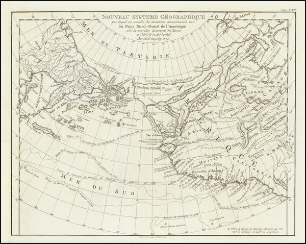
Place/Date:
Amsterdam / 1774 (1777)
Size:
10.5 x 8.5 inches
Condition:
VG+
Stock#:
80212

Place/Date:
St. Petersburg / 1773
Size:
25 x 18 inches
Condition:
VG
Stock#:
90200

Place/Date:
Paris / 1772
Size:
15 x 12 inches
Condition:
VG+
Stock#:
50181
Original map showing Antique Polar Maps by Diderot & de Vaugondy made in 1772.
Place/Date:
Paris / 1772
Size:
14 x 11.5 inches
Condition:
VG+
Stock#:
84039

Place/Date:
Paris / 1766
Size:
33 x 22 inches
Condition:
VG+
Stock#:
37346ops
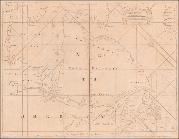
Antique Map of the Pacific Northwest and Northwest Passsage
Place/Date:
Paris / 1765
Size:
34 x 21.5 inches
Condition:
VG+
Stock#:
80022
Place/Date:
St. Petersburg / 1760
Size:
12 x 9 inches
Condition:
VG+
Stock#:
100628
Place/Date:
Paris / 1758
Size:
13.5 x 8.5 inches
Condition:
VG+
Stock#:
38760pb
Bellin's 1758 original map showing Antique Polar Maps.

Place/Date:
Paris / 1758
Size:
14 x 8 inches
Condition:
VG+
Stock#:
43313
1758 antique Bellin map showing Antique Polar Maps.
Place/Date:
Amsterdam / 1758 (1766)
Size:
25 x 18 inches
Condition:
VG
Stock#:
84790
Place/Date:
Paris / 1757
Size:
9.5 x 6.5 inches
Condition:
VG
Stock#:
78901
Place/Date:
Paris / 1757
Size:
12 x 9 inches
Condition:
VG
Stock#:
96825
Rare map showing Antique Polar Maps by Bellin, 1757.

Place/Date:
Paris / 1756 (1780)
Size:
17.5 x 13.5 inches
Condition:
VG+
Stock#:
98378
Place/Date:
Berlin / 1753 circa
Size:
12 x 12 inches Each
Condition:
VG
Stock#:
81806
Place/Date:
Berlin / 1753
Size:
12 x 12 inches Each
Condition:
VG
Stock#:
102686
Place/Date:
Paris / 1752
Size:
25 x 18 inches
Condition:
VG+
Stock#:
74874
Place/Date:
London / 1750 circa
Size:
22 x 17.5 inches
Condition:
VG
Stock#:
60417
Rare map showing Antique Polar Maps by Mount & Page made in 1750.