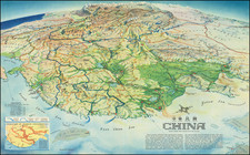
Search
Richard Edes Harrison was a distinguished American scientific illustrator and cartographer, widely acknowledged for his innovative data visualization and cartographic methods. Harrison was notably the house cartographer for "Fortune" magazine and served as a consultant at "Life" for nearly two decades. His contributions were pivotal in reshaping cartographic perspectives and influencing spatial thinking.
The son of biologist Ross Granville Harrison, Richard grew up in New Haven and pursued his education at Yale College. He graduated with a major in zoology and a minor in chemistry. Initially, Harrison worked as a draftsman for architect Cass Gilbert and aspired to become an architect himself. This led him to the Yale School of Fine Arts in 1926, where he studied for four years. However, the economic downturn of the Great Depression impacted the field of architecture, prompting Harrison to shift his focus to design work.
Harrison's entry into cartography in 1935 was somewhat serendipitous, stemming from a friend's request to temporarily replace a mapmaker at "Fortune." During World War II, his cartographic visualizations gained significant popularity. He advocated for a multi-perspective approach to geographic issues and critiqued conventional practices, such as the overreliance on the Mercator projection and the standard placement of north at the top of maps.
His groundbreaking work included the azimuthal projection map titled "The World Divided," first published in "Fortune" in August 1941. This map, which was extensively replicated, underscored the United States' central role in global conflict. A later version, "One World, One War," appeared in "Fortune" in March 1942 and was ordered in large quantities by the U.S. Army. Harrison’s design influenced the creation of the United Nations logo and his maps were characterized by their unique tilted perspectives.
Despite considering himself more of an artist than a cartographer, Harrison had a highly successful career in mapmaking. He was part of the staff at "Fortune" from 1936 to 1938 and worked as a map consultant at the State Department and the Office of Strategic Services, the CIA's precursor, in the 1940s and 1950s. His expertise was also sought by the Museum of Modern Art. Harrison lectured at several universities, including Clark, Syracuse, Columbia, and Trinity, and was a member of both the American Geographical Society and the Royal Geographical Society.
His contributions extended to the realm of geopolitics, where he produced maps for Nicholas Spykman's "America's Strategy in World Politics," a seminal work in 20th-century geopolitics. Harrison's legacy in cartography and data visualization remains significant, as he fundamentally challenged and transformed the way maps were perceived and used in understanding world affairs.
Archived