Search
Piadyshev was the cartographer at the Military-Topographical Depot of His Imperial Majesty's General Staff, during the production of the first systematic survey or Russia, with maps published between 1820 and 1827.
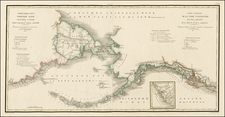
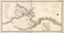
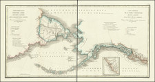
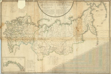
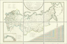
Piadyshev's Geograficheskii atlas Rossiiskoi imperii, tsarstva Pol'skogo i velikogo kniazhestva Finliandskogo (Geographical Atlas of the Russian Empire, the Kingdom of Poland, and the Grand Duchy of Finland . . . ) was the first atlas of its kind - both comprehensive and accurate - depicting an empire that stretched from the Vistula River to the Pacific Ocean. It is credited to Col. Vasilii Petrovich Piadyshev (1768-1835), who served with distinction in the Military-Topographical Depot of His Majesty's General Staff. The sheets were published between 1820 and 1827; the work underwent revision in 1828-1829 and was reprinted in 1834. The atlas is composed of 60 maps, including a general map of the empire.
Curiously, the atlas is not constructed on a consistent scale and does not use the same projection on all maps. Each sheet describes administrative boundaries, rivers, roads, urban and rural settlements, and a variety of other details. Distances are in versts (1 verst = 1.07 kilometer). On each sheet, placenames are rendered in Russian and in French transliteration.
The atlas reflects the detailed mapping carried out by Russian military cartographers in the first quarter of the 19th century. The map shows population centers (five gradations by size), fortresses, redoubts, roads (four types), provincial and district borders, plants, and factories. Distances are shown in versts, a Russian measure, now no longer used, equal to 1.07 kilometers. Legends and place-names are in Russian and French.
The atlas underwent revision in 1828-1829, and was reprinted in 1834.
Archived