|
||

|

|
|

|
Stock# m9516
Description
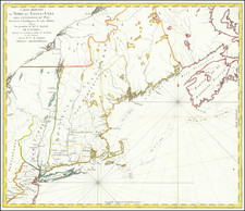
One of the earliest obtainable maps of the state. Shows counties, towns, roads, rivers, lakes, islands, chuches, court houses, and other early details. A few interesting early annotations also appear.
Condition Description
Minor soiing and misfolding.
Reference
Wheat & Brun 190.