This item has been sold, but you can enter your email address to be notified if another example becomes available.


|
||

|

|
|

|
Stock# m0694
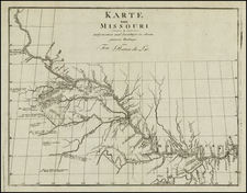
Description
A great early regional map, showing very few counties in Dakota and Western Nebraska. Indian Tribes and early roads and forts appear, along with early railroads, stations, towns, Indian Reservations, etc. Decorative border. From HH Lloyd's scarce atlas of the United States, which was never separately published and only appears in regional atlases by Warner & Beers.