This item has been sold, but you can enter your email address to be notified if another example becomes available.


|
||

|

|
|

|
Stock# m0061
Description
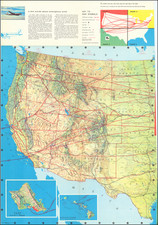
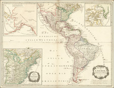
Large map of the United States, hand colored by state and showing towns, railroad routes, explorer's routes etc. The remarkable part of this map is that a small portion of land between Wyoming, Montana and Idaho is labeled as part of Dakota, the only time we have ever seen this unique location.