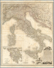
|
||

|

|
|

|
"Stato Di Milano Parte Occidentale" and "Stato Di Milano Parte Orientale" form an exquisite pair of maps of the Milan region, drawn by Vincenzo Maria Coronelli and published in his 'Corso Geographico' in Venice in 1695. The maps are notable for their high level of detail, illustrating the topography of the region, pinpointing geographical features such as mountains, rivers, lakes, towns, and castles, and featuring elegant cartouches and three coats of arms.
The late 17th century, the period when these maps were produced, was a time of burgeoning interest in geography and exploration. This was a time when cartographers were mapping the world in greater detail than ever before, striving to reflect the evolving political, cultural, and physical landscapes of their time.
Coronelli's maps of Milan embody this spirit of exploration and cartographic precision. The maps depict a region with a rich history and a vibrant culture that was a pivotal hub of trade and commerce, nestled between the Alps and the Po River.
Coronelli's work is not only valuable for its geographical accuracy but also for its aesthetic appeal. His meticulous attention to detail, the sophisticated use of cartouches, and the integration of coats of arms all contribute to the maps' artistic quality, rendering them as much works of art as geographical tools.
Coronelli, an Italian Franciscan friar, scholar, and cartographer, was renowned for his contributions to the fields of geography and cartography. He initially trained as a xylographer before shifting his focus to geography and cartography. His globes, especially the Terrestrial and Celestial Globes for Ranuccio II Farnese, the Duke of Parma, and Louis XIV of France, were of substantial size and impressively detailed. His work significantly influenced the cartographic depictions of the late 17th and early 18th centuries.
In conclusion, "Stato Di Milano Parte Occidentale" and "Stato Di Milano Parte Orientale" offer a detailed and artfully composed snapshot of the Milan region in the late 17th century, representing a significant contribution to the cartographic record of the time.
Vincenzo Maria Coronelli (1650-1718) was one of the most influential Italian mapmakers and was known especially for his globes and atlases. The son of a tailor, Vincenzo was apprenticed to a xylographer (a wood block engraver) at a young age. At fifteen he became a novice in a Franciscan monastery. At sixteen he published his first book, the first of 140 publications he would write in his lifetime. The order recognized his intellectual ability and saw him educated in Venice and Rome. He earned a doctorate in theology, but also studied astronomy. By the late 1670s, he was working on geography and was commissioned to create a set of globes for the Duke of Parma. These globes were five feet in diameter. The Parma globes led to Coronelli being named theologian to the Duke and receiving a bigger commission, this one from Louis XIV of France. Coronelli moved to Paris for two years to construct the King’s huge globes, which are 12.5 feet in diameter and weigh 2 tons.
The globes for the French King led to a craze for Coronelli’s work and he traveled Europe making globes for the ultra-elite. By 1705, he had returned to Venice. There, he founded the first geographical society, the Accademia Cosmografica degli Argonauti and was named Cosmographer of the Republic of Venice. He died in 1718.
![[Certosa di Valmanera, Asti, Piedmont] Cartusia Astensis](https://storage.googleapis.com/raremaps/img/small/89102.jpg)
![[ Lazio ] Campagna di Roma, olim Latium: Patrimonio Di S. Pietro; et Sabina](https://storage.googleapis.com/raremaps/img/small/98622.jpg)
![[Savona Province and Environs]](https://storage.googleapis.com/raremaps/img/small/65400.jpg)
![[ Istria / Croatia / Slovenia / Fruili ] Forum Iulium Karstia, Carniola Histria et Windorum Marchia](https://storage.googleapis.com/raremaps/img/small/61612.jpg)