


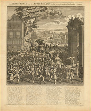
|
||

|

|
|

|
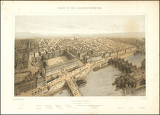
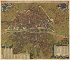
A meticulously detailed 1831 map, "Nouveau Plan Routier de Paris ou Guide Exact Dans Cette Capitale," created by A. Toussaint, featuring the city of Paris divided into 12 arrondissements and 48 quartiers, with an extensive key of streets and a list of arrondissements or mairies, published by Mme. Vve. (i.e., Madame Veuve, "Mrs. Widow") Turgis.
This remarkable map captures the urban landscape of Paris in the early 19th century, a period of significant transformation as the city underwent modernization and growth. The map showcases the division of Paris into 12 arrondissements, a municipal organization that would later be expanded in 1860. The 48 quartiers within these arrondissements are also illustrated, providing a comprehensive view of the city's layout at the time.
The extensive key of streets found on the left and right sides of the map image provides valuable information for navigating the city, reflecting the map's practical purpose as a guide for residents and visitors alike. Additionally, a list titled "Arrondissements ou Mairies" offers further insight into the administrative divisions of Paris during this period.
Published by Mme. Vve. Turgis in Paris and Toulouse, this map is not only an invaluable historical record but also a testament to the cartographic craftsmanship of its time. Its intricate detail and precise representation of Parisian streets and neighborhoods offer a fascinating snapshot of the French capital as it appeared in the early 19th century.
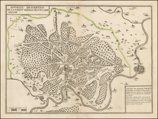
![[Paris - Soissons - Champagne / area between the Seine River, Oise, River, Aisne River and Marne Rivers]](https://storage.googleapis.com/raremaps/img/small/90932.jpg)